Le Quiou
Le Quiou
Ar C'haeoù | |
|---|---|
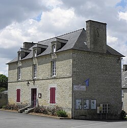 The town hall of Le Quiou | |
show Location of Le Quiou | |
 Le Quiou | |
| Coordinates: 48°21′07″N 2°00′17″W / 48.3519°N 2.0047°WCoordinates: 48°21′07″N 2°00′17″W / 48.3519°N 2.0047°W | |
| Country | France |
| Region | Brittany |
| Department | Côtes-d'Armor |
| Arrondissement | Dinan |
| Canton | Lanvallay |
| Intercommunality | Dinan Agglomération |
| Government | |
| • Mayor (2020–2026) | Arnaud Carré[1] |
| Area 1 | 5.06 km2 (1.95 sq mi) |
| Population (Jan. 2018)[2] | 319 |
| • Density | 63/km2 (160/sq mi) |
| Time zone | UTC+01:00 (CET) |
| • Summer (DST) | UTC+02:00 (CEST) |
| INSEE/Postal code | 22263 /22630 |
| Elevation | 13–77 m (43–253 ft) |
| 1 French Land Register data, which excludes lakes, ponds, glaciers > 1 km2 (0.386 sq mi or 247 acres) and river estuaries. | |


Le Quiou (French pronunciation: [lə kju]; Breton: Ar C'haeoù) is a commune in the Côtes-d'Armor department of Brittany in northwestern France.
Population[]
| Year | Pop. | ±% |
|---|---|---|
| 1962 | 326 | — |
| 1968 | 331 | +1.5% |
| 1975 | 319 | −3.6% |
| 1982 | 313 | −1.9% |
| 1990 | 286 | −8.6% |
| 1999 | 305 | +6.6% |
| 2008 | 327 | +7.2% |
The inhabitants of Le Quiou are known in French as quiousiens.
See also[]
References[]
- ^ "Répertoire national des élus: les maires". data.gouv.fr, Plateforme ouverte des données publiques françaises (in French). 2 December 2020.
- ^ "Populations légales 2018". INSEE. 28 December 2020.
External links[]
| Wikimedia Commons has media related to Le Quiou. |
- Base Mérimée: Search for heritage in the commune, Ministère français de la Culture. (in French)
| show Authority control |
|---|
This Côtes-d'Armor geographical article is a stub. You can help Wikipedia by . |
Categories:
- Communes of Côtes-d'Armor
- Côtes-d'Armor geography stubs