Lieurey
Lieurey | |
|---|---|
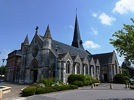 The church in Lieurey | |
 Coat of arms | |
show Location of Lieurey | |
 Lieurey | |
| Coordinates: 49°13′51″N 0°30′00″E / 49.2308°N 0.5°ECoordinates: 49°13′51″N 0°30′00″E / 49.2308°N 0.5°E | |
| Country | France |
| Region | Normandy |
| Department | Eure |
| Arrondissement | Bernay |
| Canton | Beuzeville |
| Government | |
| • Mayor (2020–2026) | Isabelle Simon[1] |
| Area 1 | 18.21 km2 (7.03 sq mi) |
| Population (Jan. 2018)[2] | 1,463 |
| • Density | 80/km2 (210/sq mi) |
| Time zone | UTC+01:00 (CET) |
| • Summer (DST) | UTC+02:00 (CEST) |
| INSEE/Postal code | 27367 /27560 |
| Elevation | 138–184 m (453–604 ft) (avg. 170 m or 560 ft) |
| 1 French Land Register data, which excludes lakes, ponds, glaciers > 1 km2 (0.386 sq mi or 247 acres) and river estuaries. | |


Lieurey (French pronunciation: [ljøʁɛ]) is a commune in the Eure department in Normandy in northern France.
Population[]
| Year | Pop. | ±% |
|---|---|---|
| 1962 | 992 | — |
| 1968 | 1,060 | +6.9% |
| 1975 | 1,051 | −0.8% |
| 1982 | 1,075 | +2.3% |
| 1990 | 1,155 | +7.4% |
| 1999 | 1,186 | +2.7% |
| 2008 | 1,374 | +15.9% |
International relations[]
The 14 communes of the former canton of Saint-Georges-du-Vièvre (Normandy, France), including Lieurey, are twinned with Slimbridge (Gloucestershire, England).
See also[]
- Communes of the Eure department
References[]
- ^ "Répertoire national des élus: les maires". data.gouv.fr, Plateforme ouverte des données publiques françaises (in French). 2 December 2020.
- ^ "Populations légales 2018". INSEE. 28 December 2020.
| Wikimedia Commons has media related to Lieurey. |
| show Communes of the Eure department |
|---|
This Eure geographical article is a stub. You can help Wikipedia by . |
Categories:
- Communes of Eure
- Eure geography stubs