Quillebeuf-sur-Seine
Quillebeuf-sur-Seine | |
|---|---|
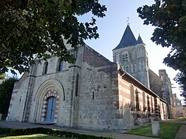 The church in Quillebeuf | |
 Coat of arms | |
show Location of Quillebeuf-sur-Seine | |
 Quillebeuf-sur-Seine | |
| Coordinates: 49°28′22″N 0°31′37″E / 49.4728°N 0.5269°ECoordinates: 49°28′22″N 0°31′37″E / 49.4728°N 0.5269°E | |
| Country | France |
| Region | Normandy |
| Department | Eure |
| Arrondissement | Bernay |
| Canton | Bourg-Achard |
| Intercommunality | Pont-Audemer / Val de Risle |
| Government | |
| • Mayor (2020–2026) | Carine Boquet |
| Area 1 | 10.11 km2 (3.90 sq mi) |
| Population (Jan. 2018)[1] | 839 |
| • Density | 83/km2 (210/sq mi) |
| Time zone | UTC+01:00 (CET) |
| • Summer (DST) | UTC+02:00 (CEST) |
| INSEE/Postal code | 27485 /27680 |
| Elevation | 0–23 m (0–75 ft) (avg. 10 m or 33 ft) |
| 1 French Land Register data, which excludes lakes, ponds, glaciers > 1 km2 (0.386 sq mi or 247 acres) and river estuaries. | |


Quillebeuf-sur-Seine (French pronunciation: [kijbœf syʁ sɛn], literally Quillebeuf on Seine) is a commune in the north-western part of the Eure department in Normandy in northern France.
Quillebeuf, which is an old port, is located on left bank of the Seine. The town is connected to Port-Jérôme-sur-Seine, in Seine-Maritime via a car ferry.
Population[]
|
|
See also[]
- Communes of the Eure department
References[]
- ^ "Populations légales 2018". INSEE. 28 December 2020.
| Wikimedia Commons has media related to Quillebeuf-sur-Seine. |
| show Communes of the Eure department |
|---|
| show Authority control |
|---|
This Eure geographical article is a stub. You can help Wikipedia by . |
Categories:
- Communes of Eure
- Eure geography stubs