Saint-Marcel, Eure
From Wikipedia, the free encyclopedia
Commune in Normandy, France
Saint-Marcel | |
|---|---|
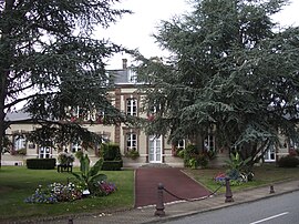 The town hall in Saint-Marcel | |
 Coat of arms | |
 Saint-Marcel  Saint-Marcel | |
Coordinates:  49°05′49″N 1°26′47″E / 49.0969°N 1.4464°E / 49.0969; 1.4464Coordinates: 49°05′49″N 1°26′47″E / 49.0969°N 1.4464°E / 49.0969; 1.4464 49°05′49″N 1°26′47″E / 49.0969°N 1.4464°E / 49.0969; 1.4464Coordinates: 49°05′49″N 1°26′47″E / 49.0969°N 1.4464°E / 49.0969; 1.4464 | |
| Country | France |
| Region | Normandy |
| Department | Eure |
| Arrondissement | Les Andelys |
| Canton | Pacy-sur-Eure |
| Government | |
| • Mayor (2008–2014) | Gérard Volpatti |
| Area 1 | 9.93 km2 (3.83 sq mi) |
| Population (Jan. 2018)[1] | 4,446 |
| • Density | 450/km2 (1,200/sq mi) |
| Time zone | UTC+01:00 (CET) |
| • Summer (DST) | UTC+02:00 (CEST) |
| INSEE/Postal code | 27562 /27950 |
| Elevation | 12–141 m (39–463 ft) (avg. 85 m or 279 ft) |
| 1 French Land Register data, which excludes lakes, ponds, glaciers > 1 km2 (0.386 sq mi or 247 acres) and river estuaries. | |

Saint-Marcel is a commune in the Eure department in Normandy in northern France.
Population[]
| Year | Pop. | ±% |
|---|---|---|
| 1936 | 1,244 | — |
| 1954 | 1,532 | +23.2% |
| 1962 | 1,701 | +11.0% |
| 1968 | 3,470 | +104.0% |
| 1975 | 4,198 | +21.0% |
| 1982 | 4,434 | +5.6% |
| 1990 | 4,398 | −0.8% |
| 1999 | 4,982 | +13.3% |
| 2008 | 4,967 | −0.3% |
See also[]
- Communes of the Eure department
References[]
- ^ "Populations légales 2018". INSEE. 28 December 2020.
| Wikimedia Commons has media related to Saint-Marcel (Eure). |
show
Communes of the Eure department | |
|---|---|
|
| show Authority control | |
|---|---|
| General | |
| National libraries | |
| Other | |
This Eure geographical article is a stub. You can help Wikipedia by . |
- v
- t
Retrieved from ""
Categories:
- Communes of Eure
- Eure geography stubs
Hidden categories:
- Articles with short description
- Short description is different from Wikidata
- Infobox mapframe without OSM relation ID on Wikidata
- Coordinates on Wikidata
- Pages using infobox settlement with image map1 but not image map
- Commons category link is on Wikidata
- Articles with VIAF identifiers
- Articles with BNF identifiers
- Articles with MusicBrainz area identifiers
- Articles with SUDOC identifiers
- Articles with WORLDCATID identifiers
- All stub articles
- Pages using the Kartographer extension