Touffreville, Eure
From Wikipedia, the free encyclopedia
Commune in Normandy, France
Touffreville | |
|---|---|
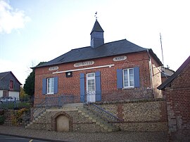 The town hall. | |
 Touffreville  Touffreville | |
Coordinates:  49°21′05″N 1°26′31″E / 49.3514°N 1.4419°E / 49.3514; 1.4419Coordinates: 49°21′05″N 1°26′31″E / 49.3514°N 1.4419°E / 49.3514; 1.4419 49°21′05″N 1°26′31″E / 49.3514°N 1.4419°E / 49.3514; 1.4419Coordinates: 49°21′05″N 1°26′31″E / 49.3514°N 1.4419°E / 49.3514; 1.4419 | |
| Country | France |
| Region | Normandy |
| Department | Eure |
| Arrondissement | Les Andelys |
| Canton | Romilly-sur-Andelle |
| Intercommunality | Lyons Andelle |
| Government | |
| • Mayor (2014-2020) | Bernard Herman |
| Area 1 | 10.68 km2 (4.12 sq mi) |
| Population (Jan. 2018)[1] | 352 |
| • Density | 33/km2 (85/sq mi) |
| Time zone | UTC+01:00 (CET) |
| • Summer (DST) | UTC+02:00 (CEST) |
| INSEE/Postal code | 27649 /27440 |
| Elevation | 49–162 m (161–531 ft) (avg. 53 m or 174 ft) |
| 1 French Land Register data, which excludes lakes, ponds, glaciers > 1 km2 (0.386 sq mi or 247 acres) and river estuaries. | |

Touffreville is a commune in the Eure department in Normandy in north-western France.
Population[]
| Year | Pop. | ±% |
|---|---|---|
| 1793 | 384 | — |
| 1841 | 459 | +19.5% |
| 1866 | 350 | −23.7% |
| 1911 | 254 | −27.4% |
| 1962 | 249 | −2.0% |
| 1968 | 295 | +18.5% |
| 1975 | 266 | −9.8% |
| 1982 | 277 | +4.1% |
| 1990 | 278 | +0.4% |
| 1999 | 277 | −0.4% |
| 2006 | 308 | +11.2% |
| 2007 | 312 | +1.3% |
| 2011 | 335 | +7.4% |
See also[]
- Communes of the Eure department
References[]
- ^ "Populations légales 2018". INSEE. 28 December 2020.

Saint-Pierre church.
| Wikimedia Commons has media related to Touffreville. |
show
Communes of the Eure department | |
|---|---|
|
This Eure geographical article is a stub. You can help Wikipedia by . |
- v
- t
Retrieved from ""
Categories:
- Communes of Eure
- Eure geography stubs
Hidden categories:
- Articles with short description
- Short description is different from Wikidata
- Infobox mapframe without OSM relation ID on Wikidata
- Coordinates on Wikidata
- Pages using infobox settlement with image map1 but not image map
- Commons category link is on Wikidata
- Articles with BNF identifiers
- All stub articles
- Pages using the Kartographer extension