Boule-d'Amont
Boule-d'Amont
Bula d'Amunt | |
|---|---|
 The Serrabone Priory and church | |
show Location of Boule-d'Amont | |
 Boule-d'Amont | |
| Coordinates: 42°34′50″N 2°36′51″E / 42.5806°N 2.6142°ECoordinates: 42°34′50″N 2°36′51″E / 42.5806°N 2.6142°E | |
| Country | France |
| Region | Occitanie |
| Department | Pyrénées-Orientales |
| Arrondissement | Prades |
| Canton | Le Canigou |
| Intercommunality | Roussillon Conflent |
| Government | |
| • Mayor (2020–2026) | Claudine Botebol[1] |
| Area 1 | 23.22 km2 (8.97 sq mi) |
| Population (Jan. 2018)[2] | 55 |
| • Density | 2.4/km2 (6.1/sq mi) |
| Time zone | UTC+01:00 (CET) |
| • Summer (DST) | UTC+02:00 (CEST) |
| INSEE/Postal code | 66022 /66130 |
| Elevation | 234–1,348 m (768–4,423 ft) (avg. 483 m or 1,585 ft) |
| 1 French Land Register data, which excludes lakes, ponds, glaciers > 1 km2 (0.386 sq mi or 247 acres) and river estuaries. | |


Boule-d'Amont (Catalan: Bula d'Amunt) is a commune in the Pyrénées-Orientales department in southern France.
Geography[]
Localisation[]
Boule-d'Amont is located in the canton of Le Canigou and in the arrondissement of Prades.
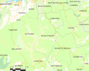
Map of Boule-d'Amont and its surrounding communes
| show Places adjacent to Boule-d'Amont |
|---|
Government and politics[]
| Mayor | Term start | Term end |
|---|---|---|
| Fulcran Mazollier | 1977 | 1983 |
| Gérard Llense | 1983 | 2014 |
| Yann Oheix | 2014 | 2020 |
| Claudine Botebol | 2020 | incumbent |
Population[]
|
|
See also[]
References[]
- ^ "Répertoire national des élus: les maires". data.gouv.fr, Plateforme ouverte des données publiques françaises (in French). 2 December 2020.
- ^ "Populations légales 2018". INSEE. 28 December 2020.
| Wikimedia Commons has media related to Boule-d'Amont. |
| show Authority control |
|---|
This Pyrénées-Orientales geographical article is a stub. You can help Wikipedia by . |
Categories:
- Communes of Pyrénées-Orientales
- Pyrénées-Orientales geography stubs