Espira-de-Conflent
Espira-de-Conflent
Espirà de Conflent (Catalan) | |
|---|---|
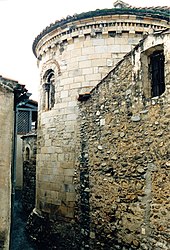 The church of Sainte-Marie, in Espira-de-Conflent | |
 Coat of arms | |
show Location of Espira-de-Conflent | |
 Espira-de-Conflent | |
| Coordinates: 42°37′05″N 2°29′56″E / 42.6181°N 2.4989°ECoordinates: 42°37′05″N 2°29′56″E / 42.6181°N 2.4989°E | |
| Country | France |
| Region | Occitanie |
| Department | Pyrénées-Orientales |
| Arrondissement | Prades |
| Canton | Le Canigou |
| Intercommunality | Conflent Canigó |
| Government | |
| • Mayor (2020–2026) | Roger Paillès |
| Area 1 | 6.03 km2 (2.33 sq mi) |
| Population (Jan. 2018)[1] | 168 |
| • Density | 28/km2 (72/sq mi) |
| Time zone | UTC+01:00 (CET) |
| • Summer (DST) | UTC+02:00 (CEST) |
| INSEE/Postal code | 66070 /66320 |
| Elevation | 260–767 m (853–2,516 ft) (avg. 330 m or 1,080 ft) |
| 1 French Land Register data, which excludes lakes, ponds, glaciers > 1 km2 (0.386 sq mi or 247 acres) and river estuaries. | |


Espira-de-Conflent (Catalan: Espirà de Conflent) is a commune in the Pyrénées-Orientales department in southern France.
Geography[]
Localisation[]
Espira-de-Conflent is located in the canton of Le Canigou and in the arrondissement of Prades.

Map of Espira-de-Conflent and its surrounding communes
| show Places adjacent to Espira-de-Conflent |
|---|
Population[]
| Year | Pop. | ±% p.a. |
|---|---|---|
| 1968 | 162 | — |
| 1975 | 121 | −4.08% |
| 1982 | 124 | +0.35% |
| 1990 | 132 | +0.78% |
| 1999 | 125 | −0.60% |
| 2006 | 175 | +4.92% |
| 2007 | 178 | +1.71% |
| 2011 | 167 | −1.58% |
| 2012 | 169 | +1.20% |
| 2015 | 171 | +0.39% |
| 2016 | 171 | +0.00% |
| 2017 | 168 | −1.75% |
| 2018 | 168 | +0.00% |
| Source: INSEE[2] | ||
The inhabitants of the commune are known as Espiranois(es).
See also[]
References[]
- ^ "Populations légales 2018". INSEE. 28 December 2020.
- ^ Population en historique depuis 1968, INSEE
| Wikimedia Commons has media related to Espira-de-Conflent. |
| show Authority control |
|---|
This Pyrénées-Orientales geographical article is a stub. You can help Wikipedia by . |
Categories:
- Communes of Pyrénées-Orientales
- Pyrénées-Orientales geography stubs