Le Soler
Le Soler
El Soler | |
|---|---|
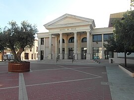 The town hall in Le Soler | |
Location of Le Soler  | |
 Le Soler | |
| Coordinates: 42°40′58″N 2°47′38″E / 42.6828°N 2.7939°ECoordinates: 42°40′58″N 2°47′38″E / 42.6828°N 2.7939°E | |
| Country | France |
| Region | Occitanie |
| Department | Pyrénées-Orientales |
| Arrondissement | Perpignan |
| Canton | La Vallée de la Têt |
| Intercommunality | Perpignan Méditerranée Métropole |
| Government | |
| • Mayor (2020–2026) | Armelle Revel Fourcade[1] |
| Area 1 | 10.35 km2 (4.00 sq mi) |
| Population (Jan. 2018)[2] | 7,753 |
| • Density | 750/km2 (1,900/sq mi) |
| Time zone | UTC+01:00 (CET) |
| • Summer (DST) | UTC+02:00 (CEST) |
| INSEE/Postal code | 66195 /66270 |
| Elevation | 43–92 m (141–302 ft) (avg. 73 m or 240 ft) |
| 1 French Land Register data, which excludes lakes, ponds, glaciers > 1 km2 (0.386 sq mi or 247 acres) and river estuaries. | |

Le Soler (Catalan: El Soler) is a commune in the Pyrénées-Orientales department in southern France.
Geography[]
Le Soler is located in the canton of La Vallée de la Têt and in the arrondissement of Perpignan.

Map of Le Soler and its surrounding communes
Population[]
| Year | Pop. | ±% p.a. |
|---|---|---|
| 1968 | 2,715 | — |
| 1975 | 3,340 | +3.00% |
| 1982 | 4,401 | +4.02% |
| 1990 | 5,147 | +1.98% |
| 1999 | 5,825 | +1.38% |
| 2007 | 6,630 | +1.63% |
| 2012 | 7,221 | +1.72% |
| 2017 | 7,710 | +1.32% |
| Source: INSEE[3] | ||
See also[]
References[]
- ^ "Répertoire national des élus: les maires". data.gouv.fr, Plateforme ouverte des données publiques françaises (in French). 2 December 2020.
- ^ "Populations légales 2018". INSEE. 28 December 2020.
- ^ Population en historique depuis 1968, INSEE
| Wikimedia Commons has media related to Le Soler. |
This Pyrénées-Orientales geographical article is a stub. You can help Wikipedia by . |
Categories:
- Communes of Pyrénées-Orientales
- Pyrénées-Orientales geography stubs