Nyer
Nyer | |
|---|---|
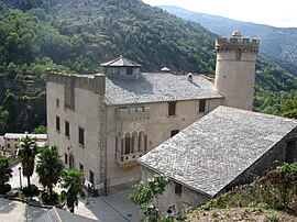 The château in Nyer | |
 Coat of arms | |
show Location of Nyer | |
 Nyer | |
| Coordinates: 42°32′04″N 2°16′36″E / 42.5344°N 2.2767°ECoordinates: 42°32′04″N 2°16′36″E / 42.5344°N 2.2767°E | |
| Country | France |
| Region | Occitanie |
| Department | Pyrénées-Orientales |
| Arrondissement | Prades |
| Canton | Les Pyrénées catalanes |
| Government | |
| • Mayor (2020–2026) | André Argilès[1] |
| Area 1 | 37.00 km2 (14.29 sq mi) |
| Population (Jan. 2018)[2] | 150 |
| • Density | 4.1/km2 (10/sq mi) |
| Time zone | UTC+01:00 (CET) |
| • Summer (DST) | UTC+02:00 (CEST) |
| INSEE/Postal code | 66123 /66360 |
| Elevation | 656–2,645 m (2,152–8,678 ft) (avg. 734 m or 2,408 ft) |
| 1 French Land Register data, which excludes lakes, ponds, glaciers > 1 km2 (0.386 sq mi or 247 acres) and river estuaries. | |


Nyer (French pronunciation: [ɲɛʁ] (![]() listen); Catalan: Nyer) is a commune in the Pyrénées-Orientales department in southern France.
listen); Catalan: Nyer) is a commune in the Pyrénées-Orientales department in southern France.
Geography[]
Nyer is located in the canton of Les Pyrénées catalanes and in the arrondissement of Prades.

Map of Nyer and its surrounding communes
Population[]
| Year | Pop. | ±% p.a. |
|---|---|---|
| 1968 | 137 | — |
| 1975 | 112 | −2.84% |
| 1982 | 140 | +3.24% |
| 1990 | 132 | −0.73% |
| 1999 | 108 | −2.21% |
| 2007 | 178 | +6.44% |
| 2012 | 160 | −2.11% |
| 2017 | 148 | −1.55% |
| Source: INSEE[3] | ||
See also[]
References[]
- ^ "Répertoire national des élus: les maires". data.gouv.fr, Plateforme ouverte des données publiques françaises (in French). 2 December 2020. Retrieved 7 December 2020.
- ^ "Populations légales 2018". INSEE. 28 December 2020.
- ^ Population en historique depuis 1968, INSEE
| Wikimedia Commons has media related to Nyer. |
| show Authority control |
|---|
This Pyrénées-Orientales geographical article is a stub. You can help Wikipedia by . |
Categories:
- Communes of Pyrénées-Orientales
- Pyrénées-Orientales geography stubs