Néfiach
Néfiach
Nefiac | |
|---|---|
 A general view of Néfiach | |
show Location of Néfiach | |
 Néfiach | |
| Coordinates: 42°41′41″N 2°40′04″E / 42.6947°N 2.6678°ECoordinates: 42°41′41″N 2°40′04″E / 42.6947°N 2.6678°E | |
| Country | France |
| Region | Occitanie |
| Department | Pyrénées-Orientales |
| Arrondissement | Prades |
| Canton | La Vallée de la Têt |
| Intercommunality | Roussillon Conflent |
| Government | |
| • Mayor (2020–2026) | Patrice Vila |
| Area 1 | 8.81 km2 (3.40 sq mi) |
| Population (Jan. 2018)[1] | 1,292 |
| • Density | 150/km2 (380/sq mi) |
| Time zone | UTC+01:00 (CET) |
| • Summer (DST) | UTC+02:00 (CEST) |
| INSEE/Postal code | 66121 /66170 |
| Elevation | 104–301 m (341–988 ft) |
| 1 French Land Register data, which excludes lakes, ponds, glaciers > 1 km2 (0.386 sq mi or 247 acres) and river estuaries. | |


Néfiach (French pronunciation: [nefjak] (![]() listen); Catalan: Nefiac) is a commune in the Pyrénées-Orientales department in southern France. It is very beautiful with beautiful surroundings.
listen); Catalan: Nefiac) is a commune in the Pyrénées-Orientales department in southern France. It is very beautiful with beautiful surroundings.
Geography[]
Néfiach is located in the canton of La Vallée de la Têt and in the arrondissement of Perpignan.
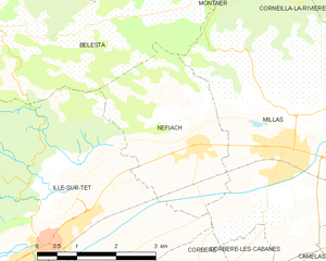
Map of Néfiach and its surrounding communes
Population[]
| Year | Pop. | ±% p.a. |
|---|---|---|
| 1968 | 830 | — |
| 1975 | 746 | −1.51% |
| 1982 | 713 | −0.64% |
| 1990 | 835 | +1.99% |
| 1999 | 789 | −0.63% |
| 2007 | 992 | +2.90% |
| 2012 | 1,206 | +3.98% |
| 2017 | 1,280 | +1.20% |
| Source: INSEE[2] | ||
See also[]
References[]
- ^ "Populations légales 2018". INSEE. 28 December 2020.
- ^ Population en historique depuis 1968, INSEE
| Wikimedia Commons has media related to Néfiach. |
| Authority control |
|---|
This Pyrénées-Orientales geographical article is a stub. You can help Wikipedia by . |
Categories:
- Communes of Pyrénées-Orientales
- Pyrénées-Orientales geography stubs