La Llagonne
La Llagonne
La Llaguna | |
|---|---|
 An aerial view of La Llagonne | |
 Coat of arms | |
show Location of La Llagonne | |
 La Llagonne | |
| Coordinates: 42°31′38″N 2°07′18″E / 42.5272°N 2.1217°ECoordinates: 42°31′38″N 2°07′18″E / 42.5272°N 2.1217°E | |
| Country | France |
| Region | Occitanie |
| Department | Pyrénées-Orientales |
| Arrondissement | Prades |
| Canton | Les Pyrénées catalanes |
| Intercommunality | Pyrénées Catalanes |
| Government | |
| • Mayor (2020–2026) | Jean-Pierre Astruch |
| Area 1 | 23.09 km2 (8.92 sq mi) |
| Population (Jan. 2018)[1] | 220 |
| • Density | 9.5/km2 (25/sq mi) |
| Time zone | UTC+01:00 (CET) |
| • Summer (DST) | UTC+02:00 (CEST) |
| INSEE/Postal code | 66098 /66210 |
| Elevation | 1,546–2,196 m (5,072–7,205 ft) (avg. 1,657 m or 5,436 ft) |
| 1 French Land Register data, which excludes lakes, ponds, glaciers > 1 km2 (0.386 sq mi or 247 acres) and river estuaries. | |


La Llagonne (French: [la jagɔn] (![]() listen); Catalan: La Llaguna) is a commune in the Pyrénées-Orientales department in southern France.
listen); Catalan: La Llaguna) is a commune in the Pyrénées-Orientales department in southern France.
Geography[]
La Llagonne is located in the canton of Les Pyrénées catalanes and in the arrondissement of Prades.
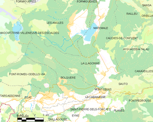
Map of La Llagonne and its surrounding communes
History[]
First time skiing in the Pyrénées happened on January 29, 1901 at La Llagonne.[2]
Population[]
| Year | Pop. | ±% p.a. |
|---|---|---|
| 1968 | 164 | — |
| 1975 | 138 | −2.44% |
| 1982 | 214 | +6.47% |
| 1990 | 243 | +1.60% |
| 1999 | 263 | +0.88% |
| 2007 | 274 | +0.51% |
| 2012 | 238 | −2.78% |
| 2017 | 219 | −1.65% |
| Source: INSEE[3] | ||
See also[]
References[]
- ^ "Populations légales 2018". INSEE. 28 December 2020.
- ^ Cárdenas, Fabricio (2014). 66 petites histoires du Pays Catalan [66 Little Stories of Catalan Country] (in French). Perpignan: Ultima Necat. ISBN 978-2-36771-006-8. OCLC 893847466.
- ^ Population en historique depuis 1968, INSEE
| Wikimedia Commons has media related to La Llagonne. |
| show Authority control |
|---|
This Pyrénées-Orientales geographical article is a stub. You can help Wikipedia by . |
Categories:
- Communes of Pyrénées-Orientales
- Pyrénées-Orientales geography stubs