Calce, Pyrénées-Orientales
Calce | |
|---|---|
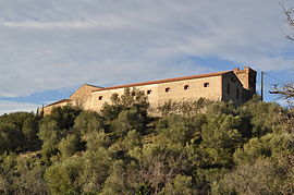 The château of Mas de Las Fons | |
 Coat of arms | |
show Location of Calce | |
 Calce | |
| Coordinates: 42°45′35″N 2°45′16″E / 42.7597°N 2.7544°ECoordinates: 42°45′35″N 2°45′16″E / 42.7597°N 2.7544°E | |
| Country | France |
| Region | Occitanie |
| Department | Pyrénées-Orientales |
| Arrondissement | Perpignan |
| Canton | Le Ribéral |
| Intercommunality | Perpignan Méditerranée Métropole |
| Government | |
| • Mayor (2020–2026) | Bruno Valiente |
| Area 1 | 23.77 km2 (9.18 sq mi) |
| Population (Jan. 2018)[1] | 208 |
| • Density | 8.8/km2 (23/sq mi) |
| Time zone | UTC+01:00 (CET) |
| • Summer (DST) | UTC+02:00 (CEST) |
| INSEE/Postal code | 66030 /66600 |
| Elevation | 54–330 m (177–1,083 ft) (avg. 228 m or 748 ft) |
| 1 French Land Register data, which excludes lakes, ponds, glaciers > 1 km2 (0.386 sq mi or 247 acres) and river estuaries. | |


Calce (French pronunciation: [kals] (![]() listen); Catalan: Calce) is a commune in the Pyrénées-Orientales department in southern France.
listen); Catalan: Calce) is a commune in the Pyrénées-Orientales department in southern France.
Geography[]
Localisation[]
Calce is located in the canton of Le Ribéral and in the arrondissement of Perpignan.

Map of Calce and its surrounding communes
| show Places adjacent to Calce, Pyrénées-Orientales |
|---|
Government and politics[]
Mayors[]
| Mayor | Term start | Term end |
|---|---|---|
| Gil Deluncle[2] | ? | 1815 |
| Pierre Deluncle Vidal[2] | 1815 | ? |
| Paul Schramm | 2001 | 2014 |
| Bruno Valiente | 2014 |
Population[]
| Year | Pop. | ±% p.a. |
|---|---|---|
| 1968 | 135 | — |
| 1975 | 116 | −2.14% |
| 1982 | 124 | +0.96% |
| 1990 | 161 | +3.32% |
| 1999 | 185 | +1.56% |
| 2007 | 225 | +2.48% |
| 2012 | 217 | −0.72% |
| 2017 | 210 | −0.65% |
| Source: INSEE[3] | ||
See also[]
References[]
- ^ "Populations légales 2018". INSEE. 28 December 2020.
- ^ Jump up to: a b (in French) Fabricio Cardenas, Vieux papiers des Pyrénées-Orientales, Calce, le 18 juin 1815, 14 january 2014
- ^ Population en historique depuis 1968, INSEE
| Wikimedia Commons has media related to Calce. |
This Pyrénées-Orientales geographical article is a stub. You can help Wikipedia by . |
Categories:
- Communes of Pyrénées-Orientales
- Pyrénées-Orientales geography stubs