Théza
Théza
Tesà | |
|---|---|
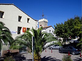 The Place de la promenade, in Théza | |
 Coat of arms | |
show Location of Théza | |
 Théza | |
| Coordinates: 42°38′20″N 2°57′13″E / 42.6389°N 2.9536°ECoordinates: 42°38′20″N 2°57′13″E / 42.6389°N 2.9536°E | |
| Country | France |
| Region | Occitanie |
| Department | Pyrénées-Orientales |
| Arrondissement | Céret |
| Canton | La Plaine d'Illibéris |
| Government | |
| • Mayor (2020–2026) | Jean Jacques Thibaut[1] |
| Area 1 | 4.83 km2 (1.86 sq mi) |
| Population (Jan. 2018)[2] | 2,084 |
| • Density | 430/km2 (1,100/sq mi) |
| Time zone | UTC+01:00 (CET) |
| • Summer (DST) | UTC+02:00 (CEST) |
| INSEE/Postal code | 66208 /66200 |
| Elevation | 13–27 m (43–89 ft) (avg. 10 m or 33 ft) |
| 1 French Land Register data, which excludes lakes, ponds, glaciers > 1 km2 (0.386 sq mi or 247 acres) and river estuaries. | |


Théza (French pronunciation: [teza] (![]() listen); Catalan: Tesà) is a commune in the Pyrénées-Orientales department in southern France.
listen); Catalan: Tesà) is a commune in the Pyrénées-Orientales department in southern France.
Geography[]
Théza is located in the canton of La Plaine d'Illibéris and in the arrondissement of Perpignan.

Map of Théza and its surrounding communes
Population[]
| Year | Pop. | ±% p.a. |
|---|---|---|
| 1968 | 554 | — |
| 1975 | 780 | +5.01% |
| 1982 | 929 | +2.53% |
| 1990 | 1,013 | +1.09% |
| 1999 | 1,252 | +2.38% |
| 2007 | 1,343 | +0.88% |
| 2012 | 1,602 | +3.59% |
| 2017 | 2,040 | +4.95% |
| Source: INSEE[3] | ||
See also[]
References[]
- ^ "Répertoire national des élus: les maires". data.gouv.fr, Plateforme ouverte des données publiques françaises (in French). 2 December 2020.
- ^ "Populations légales 2018". INSEE. 28 December 2020.
- ^ Population en historique depuis 1968, INSEE
| Wikimedia Commons has media related to Théza. |
| Authority control |
|
|---|
This Pyrénées-Orientales geographical article is a stub. You can help Wikipedia by . |
Categories:
- Communes of Pyrénées-Orientales
- Pyrénées-Orientales geography stubs