Chimilin
Chimilin | |
|---|---|
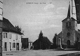 The church square at the start of the 20th century | |
show Location of Chimilin | |
 Chimilin | |
| Coordinates: 45°34′41″N 5°36′01″E / 45.5781°N 5.6003°ECoordinates: 45°34′41″N 5°36′01″E / 45.5781°N 5.6003°E | |
| Country | France |
| Region | Auvergne-Rhône-Alpes |
| Department | Isère |
| Arrondissement | La Tour-du-Pin |
| Canton | Chartreuse-Guiers |
| Intercommunality | Les Vals du Dauphiné |
| Government | |
| • Mayor (2020–2026) | Edmond Decoux |
| Area 1 | 9.66 km2 (3.73 sq mi) |
| Population (Jan. 2018)[1] | 1,432 |
| • Density | 150/km2 (380/sq mi) |
| Time zone | UTC+01:00 (CET) |
| • Summer (DST) | UTC+02:00 (CEST) |
| INSEE/Postal code | 38104 /38490 |
| Elevation | 228–362 m (748–1,188 ft) |
| 1 French Land Register data, which excludes lakes, ponds, glaciers > 1 km2 (0.386 sq mi or 247 acres) and river estuaries. | |


Chimilin (French pronunciation: [ʃimilɛ̃]) is a commune in the Isère department in southeastern France.
Population[]
| Year | Pop. | ±% |
|---|---|---|
| 1962 | 543 | — |
| 1968 | 814 | +49.9% |
| 1975 | 781 | −4.1% |
| 1982 | 942 | +20.6% |
| 1990 | 1,044 | +10.8% |
| 1999 | 1,144 | +9.6% |
| 2011 | 1,369 | +19.7% |
See also[]
References[]
- ^ "Populations légales 2018". INSEE. 28 December 2020.
| Wikimedia Commons has media related to Chimilin. |
| show Authority control |
|---|
This Isère geographical article is a stub. You can help Wikipedia by . |
Categories:
- Communes of Isère
- Isère geography stubs