Cléder
Cléder
Kleder | |
|---|---|
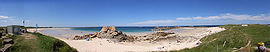 Les Amiets beach | |
 Coat of arms | |
show Location of Cléder | |
 Cléder | |
| Coordinates: 48°39′51″N 4°06′03″W / 48.6642°N 4.1008°WCoordinates: 48°39′51″N 4°06′03″W / 48.6642°N 4.1008°W | |
| Country | France |
| Region | Brittany |
| Department | Finistère |
| Arrondissement | Morlaix |
| Canton | Saint-Pol-de-Léon |
| Government | |
| • Mayor (2020–2026) | Gérard Daniélou[1] |
| Area 1 | 37.44 km2 (14.46 sq mi) |
| Population (Jan. 2018)[2] | 3,731 |
| • Density | 100/km2 (260/sq mi) |
| Time zone | UTC+01:00 (CET) |
| • Summer (DST) | UTC+02:00 (CEST) |
| INSEE/Postal code | 29030 /29233 |
| Elevation | 0–79 m (0–259 ft) |
| 1 French Land Register data, which excludes lakes, ponds, glaciers > 1 km2 (0.386 sq mi or 247 acres) and river estuaries. | |


Cléder (Breton: Kleder) is a commune in the Finistère department of Brittany in north-western France.
Population[]
Inhabitants of Cléder are called in French Clédérois.
| Year | Pop. | ±% p.a. |
|---|---|---|
| 1968 | 4,275 | — |
| 1975 | 3,923 | −1.22% |
| 1982 | 3,928 | +0.02% |
| 1990 | 3,801 | −0.41% |
| 1999 | 3,641 | −0.48% |
| 2007 | 3,807 | +0.56% |
| 2012 | 3,866 | +0.31% |
| 2017 | 3,779 | −0.45% |
| Source: INSEE[3] | ||
Breton language[]
In 2008, 25.9% of primary-school children attended bilingual schools.[4]
International relations[]
Cléder is twinned with Ashburton![]() , Herleshausen
, Herleshausen![]() and Taninges
and Taninges![]() .
.
See also[]
References[]
- ^ "Répertoire national des élus: les maires". data.gouv.fr, Plateforme ouverte des données publiques françaises (in French). 2 December 2020.
- ^ "Populations légales 2018". INSEE. 28 December 2020.
- ^ Population en historique depuis 1968, INSEE
- ^ (in French) Ofis ar Brezhoneg: Enseignement bilingue
External links[]
| Wikimedia Commons has media related to Cléder. |
- Official website (in French)
- Base Mérimée: Search for heritage in the commune, Ministère français de la Culture. (in French)
- Mayors of Finistère Association Archived 2021-03-18 at the Wayback Machine (in French)
| show Authority control |
|---|
This Finistère geographical article is a stub. You can help Wikipedia by . |
Categories:
- Communes of Finistère
- Finistère geography stubs