Le Tréhou
Le Tréhou
An Treoù-Leon | |
|---|---|
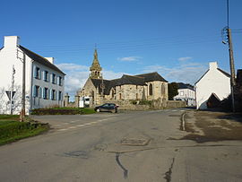 The main road and the parish church of Sainte-Pitère | |
 Coat of arms | |
show Location of Le Tréhou | |
 Le Tréhou | |
| Coordinates: 48°23′41″N 4°07′47″W / 48.3947°N 4.1297°WCoordinates: 48°23′41″N 4°07′47″W / 48.3947°N 4.1297°W | |
| Country | France |
| Region | Brittany |
| Department | Finistère |
| Arrondissement | Brest |
| Canton | Pont-de-Buis-lès-Quimerch |
| Intercommunality | Pays de Landerneau-Daoulas |
| Government | |
| • Mayor (2020–2026) | Joël Cann[1] |
| Area 1 | 22.79 km2 (8.80 sq mi) |
| Population (Jan. 2018)[2] | 637 |
| • Density | 28/km2 (72/sq mi) |
| Time zone | UTC+01:00 (CET) |
| • Summer (DST) | UTC+02:00 (CEST) |
| INSEE/Postal code | 29294 /29450 |
| Elevation | 35–171 m (115–561 ft) |
| 1 French Land Register data, which excludes lakes, ponds, glaciers > 1 km2 (0.386 sq mi or 247 acres) and river estuaries. | |


Le Tréhou (Breton: An Treoù-Leon) is a commune in the Finistère department of Brittany in north-western France.[3]
Population[]
Inhabitants of Le Tréhou are called in French Tréhousiens.
|
| ||||||||||||||||||||||||||||||||||||||||||||||||||||||||||||||||||||||||||||||||||||||||||||||||||||||||||||||||||
| Source: EHESS[4] and INSEE (1968-2017)[5] | |||||||||||||||||||||||||||||||||||||||||||||||||||||||||||||||||||||||||||||||||||||||||||||||||||||||||||||||||||
See also[]
- List of the works of Bastien and Henry Prigent
- Communes of the Finistère department
- Le Tréhou Parish close
References[]
- ^ "Répertoire national des élus: les maires". data.gouv.fr, Plateforme ouverte des données publiques françaises (in French). 2 December 2020.
- ^ "Populations légales 2018". INSEE. 28 December 2020.
- ^ Commune du Tréhou (29294), INSEE
- ^ Des villages de Cassini aux communes d'aujourd'hui: Commune data sheet Le Tréhou, EHESS. (in French)
- ^ Population en historique depuis 1968, INSEE
External links[]
| Wikimedia Commons has media related to Le Tréhou. |
- Official website (in French)
- Base Mérimée: Search for heritage in the commune, Ministère français de la Culture. (in French)
- Mayors of Finistère Association (in French)
This Finistère geographical article is a stub. You can help Wikipedia by . |
Categories:
- Communes of Finistère
- Finistère geography stubs