Tréflaouénan
Tréflaouénan
Trelaouenan | |
|---|---|
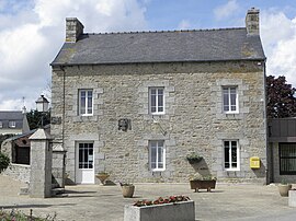 The town hall in Tréflaouénan | |
show Location of Tréflaouénan | |
 Tréflaouénan | |
| Coordinates: 48°37′43″N 4°05′42″W / 48.6286°N 4.0950°WCoordinates: 48°37′43″N 4°05′42″W / 48.6286°N 4.0950°W | |
| Country | France |
| Region | Brittany |
| Department | Finistère |
| Arrondissement | Morlaix |
| Canton | Saint-Pol-de-Léon |
| Intercommunality | Haut-Léon Communauté |
| Government | |
| • Mayor (2014–2020) | Jean-François Calarnou |
| Area 1 | 8.16 km2 (3.15 sq mi) |
| Population (Jan. 2018)[1] | 515 |
| • Density | 63/km2 (160/sq mi) |
| Time zone | UTC+01:00 (CET) |
| • Summer (DST) | UTC+02:00 (CEST) |
| INSEE/Postal code | 29285 /29440 |
| Elevation | 19–96 m (62–315 ft) |
| 1 French Land Register data, which excludes lakes, ponds, glaciers > 1 km2 (0.386 sq mi or 247 acres) and river estuaries. | |


Tréflaouénan (Breton: Trelaouenan) is a commune in the Finistère department of Brittany in north-western France.
Population[]
Inhabitants of Tréflaouénan are called in French Tréflaouénanais.
| Year | Pop. | ±% p.a. |
|---|---|---|
| 1968 | 567 | — |
| 1975 | 519 | −1.26% |
| 1982 | 509 | −0.28% |
| 1990 | 432 | −2.03% |
| 1999 | 434 | +0.05% |
| 2007 | 512 | +2.09% |
| 2012 | 526 | +0.54% |
| 2017 | 510 | −0.62% |
| Source: INSEE[2] | ||
See also[]
References[]
- ^ "Populations légales 2018". INSEE. 28 December 2020.
- ^ Population en historique depuis 1968, INSEE
External links[]
| Wikimedia Commons has media related to Tréflaouénan. |
- Base Mérimée: Search for heritage in the commune, Ministère français de la Culture. (in French)
- Mayors of Finistère Association (in French)
This Finistère geographical article is a stub. You can help Wikipedia by . |
Categories:
- Communes of Finistère
- Finistère geography stubs