La Feuillée
La Feuillée
Ar Fouilhez | |
|---|---|
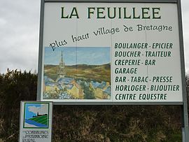 La Feuillée, the highest village in Brittany | |
 Coat of arms | |
show Location of La Feuillée | |
 La Feuillée | |
| Coordinates: 48°23′33″N 3°51′08″W / 48.3925°N 3.8522°WCoordinates: 48°23′33″N 3°51′08″W / 48.3925°N 3.8522°W | |
| Country | France |
| Region | Brittany |
| Department | Finistère |
| Arrondissement | Châteaulin |
| Canton | Carhaix-Plouguer |
| Intercommunality | Monts d'Arrée Communauté |
| Government | |
| • Mayor (2020–2026) | Jean-François Dumonteil[1] |
| Area 1 | 31.55 km2 (12.18 sq mi) |
| Population (Jan. 2018)[2] | 643 |
| • Density | 20/km2 (53/sq mi) |
| Time zone | UTC+01:00 (CET) |
| • Summer (DST) | UTC+02:00 (CEST) |
| INSEE/Postal code | 29054 /29690 |
| Elevation | 192–381 m (630–1,250 ft) |
| 1 French Land Register data, which excludes lakes, ponds, glaciers > 1 km2 (0.386 sq mi or 247 acres) and river estuaries. | |


La Feuillée (Breton: Ar Fouilhez) is a commune in the Finistère department of Brittany in north-western France.
Population[]
Inhabitants of La Feuillée are called in French Feuillantins.
|
|
|
See also[]
References[]
- ^ "Répertoire national des élus: les maires". data.gouv.fr, Plateforme ouverte des données publiques françaises (in French). 9 August 2021.
- ^ "Populations légales 2018". INSEE. 28 December 2020.
External links[]
| Wikimedia Commons has media related to La Feuillée. |
- Official website (in French)
- Base Mérimée: Search for heritage in the commune, Ministère français de la Culture. (in French)
- Mayors of Finistère Association (in French)
| show Authority control |
|---|
This Finistère geographical article is a stub. You can help Wikipedia by . |
Categories:
- Communes of Finistère
- Finistère geography stubs