Collorec
Collorec
Koloreg | |
|---|---|
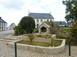 The modern fountain, with the town hall in the background, in Collorec | |
show Location of Collorec | |
 Collorec | |
| Coordinates: 48°17′09″N 3°46′22″W / 48.2858°N 3.7728°WCoordinates: 48°17′09″N 3°46′22″W / 48.2858°N 3.7728°W | |
| Country | France |
| Region | Brittany |
| Department | Finistère |
| Arrondissement | Châteaulin |
| Canton | Carhaix-Plouguer |
| Intercommunality | Haute Cornouaille |
| Government | |
| • Mayor (2014–2020) | Patrick Nicot |
| Area 1 | 28.00 km2 (10.81 sq mi) |
| Population (Jan. 2018)[1] | 609 |
| • Density | 22/km2 (56/sq mi) |
| Time zone | UTC+01:00 (CET) |
| • Summer (DST) | UTC+02:00 (CEST) |
| INSEE/Postal code | 29036 /29530 |
| Elevation | 72–221 m (236–725 ft) |
| 1 French Land Register data, which excludes lakes, ponds, glaciers > 1 km2 (0.386 sq mi or 247 acres) and river estuaries. | |


Collorec (Breton: Koloreg) is a commune in the Finistère department of Brittany in north-western France.
Demographics[]
The inhabitants of Collorec are called in French Collorecois.
|
|
|
See also[]
References[]
- ^ "Populations légales 2018". INSEE. 28 December 2020.
External links[]
| Wikimedia Commons has media related to Collorec. |
- Official website (in French)
- Base Mérimée: Search for heritage in the commune, Ministère français de la Culture. (in French)
- Mayors of Finistère Association Archived 2021-03-18 at the Wayback Machine (in French)
This Finistère geographical article is a stub. You can help Wikipedia by . |
Categories:
- Communes of Finistère
- Finistère geography stubs