Guilligomarc'h
Guilligomarc'h
Gwelegouarc'h | |
|---|---|
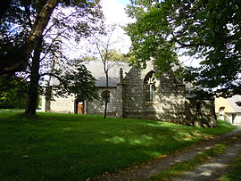 The chapel of Saint-Eloi, in Guilligomarc'h | |
show Location of Guilligomarc'h | |
 Guilligomarc'h | |
| Coordinates: 47°56′13″N 3°24′52″W / 47.9369°N 3.4144°WCoordinates: 47°56′13″N 3°24′52″W / 47.9369°N 3.4144°W | |
| Country | France |
| Region | Brittany |
| Department | Finistère |
| Arrondissement | Quimper |
| Canton | Quimperlé |
| Intercommunality | Quimperlé Communauté |
| Government | |
| • Mayor (2020–2026) | Alain Follic[1] |
| Area 1 | 22.75 km2 (8.78 sq mi) |
| Population (Jan. 2018)[2] | 779 |
| • Density | 34/km2 (89/sq mi) |
| Time zone | UTC+01:00 (CET) |
| • Summer (DST) | UTC+02:00 (CEST) |
| INSEE/Postal code | 29071 /29300 |
| Elevation | 22–148 m (72–486 ft) |
| 1 French Land Register data, which excludes lakes, ponds, glaciers > 1 km2 (0.386 sq mi or 247 acres) and river estuaries. | |


Guilligomarc'h (Breton: Gwelegouarc'h) is a commune in the Finistère department of Brittany in north-western France.
Population[]
Inhabitants of Guilligomarc'h are called in French Guillogomarc'hois.
|
|
|
See also[]
References[]
- ^ "Répertoire national des élus: les maires". data.gouv.fr, Plateforme ouverte des données publiques françaises (in French). 2 December 2020.
- ^ "Populations légales 2018". INSEE. 28 December 2020.
External links[]
| Wikimedia Commons has media related to Guilligomarc'h. |
- Official website (in French)
- Base Mérimée: Search for heritage in the commune, Ministère français de la Culture. (in French)
- Mayors of Finistère Association (in French)
This Finistère geographical article is a stub. You can help Wikipedia by . |
Categories:
- Communes of Finistère
- Finistère geography stubs