Hôpital-Camfrout
Hôpital-Camfrout
An Ospital | |
|---|---|
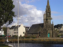 The church of Our Lady of Good News, and the | |
 Coat of arms | |
show Location of Hôpital-Camfrout | |
 Hôpital-Camfrout | |
| Coordinates: 48°19′43″N 4°14′26″W / 48.3286°N 4.2406°WCoordinates: 48°19′43″N 4°14′26″W / 48.3286°N 4.2406°W | |
| Country | France |
| Region | Brittany |
| Department | Finistère |
| Arrondissement | Brest |
| Canton | Pont-de-Buis-lès-Quimerch |
| Intercommunality | Pays de Landerneau-Daoulas |
| Government | |
| • Mayor (2014–2020) | Robert André |
| Area 1 | 13.16 km2 (5.08 sq mi) |
| Population (Jan. 2018)[1] | 2,239 |
| • Density | 170/km2 (440/sq mi) |
| Time zone | UTC+01:00 (CET) |
| • Summer (DST) | UTC+02:00 (CEST) |
| INSEE/Postal code | 29080 /29460 |
| Elevation | 0–93 m (0–305 ft) |
| 1 French Land Register data, which excludes lakes, ponds, glaciers > 1 km2 (0.386 sq mi or 247 acres) and river estuaries. | |


Hôpital-Camfrout (Breton: An Ospital) is a commune in the Finistère department and administrative region of Brittany in north-western France.
Population[]
In French the inhabitants of Hôpital-Camfrout are known as Hospitaliers or Camfroutois.
| Year | Pop. | ±% |
|---|---|---|
| 1962 | 1,290 | — |
| 1968 | 1,209 | −6.3% |
| 1975 | 1,063 | −12.1% |
| 1982 | 1,407 | +32.4% |
| 1990 | 1,505 | +7.0% |
| 1999 | 1,641 | +9.0% |
| 2008 | 1,979 | +20.6% |
| 2013 | 2,224 | +12.4% |
International relations[]
Hôpital-Camfrout is twinned with:
See also[]
References[]
- ^ "Populations légales 2018". INSEE. 28 December 2020.
- ^ "British towns twinned with French towns [via WaybackMachine.com]". Archant Community Media Ltd. Archived from the original on July 5, 2013. Retrieved 2013-07-12.
- ^ Twinning Committee for Cornwall
External links[]
| Wikimedia Commons has media related to Hôpital-Camfrout. |
- Official website (in French)
- Base Mérimée: Search for heritage in the commune, Ministère français de la Culture. (in French)
- Mayors of Finistère Association (in French)
This Finistère geographical article is a stub. You can help Wikipedia by . |
Categories:
- Communes of Finistère
- Finistère geography stubs