Dinéault
Dinéault
Dineol | |
|---|---|
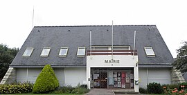 The town hall in Dinéault | |
 Coat of arms | |
show Location of Dinéault | |
 Dinéault | |
| Coordinates: 48°13′13″N 4°09′50″W / 48.2203°N 4.1639°WCoordinates: 48°13′13″N 4°09′50″W / 48.2203°N 4.1639°W | |
| Country | France |
| Region | Brittany |
| Department | Finistère |
| Arrondissement | Châteaulin |
| Canton | Crozon |
| Intercommunality | Pleyben-Châteaulin-Porzay |
| Government | |
| • Mayor (2014–2020) | Philippe Bittel |
| Area 1 | 45.96 km2 (17.75 sq mi) |
| Population (Jan. 2018)[1] | 2,069 |
| • Density | 45/km2 (120/sq mi) |
| Time zone | UTC+01:00 (CET) |
| • Summer (DST) | UTC+02:00 (CEST) |
| INSEE/Postal code | 29044 /29150 |
| Elevation | 0–326 m (0–1,070 ft) |
| 1 French Land Register data, which excludes lakes, ponds, glaciers > 1 km2 (0.386 sq mi or 247 acres) and river estuaries. | |


Dinéault (Breton: Dineol) is a commune in the Finistère department and administrative region of Brittany in north-western France.
Population[]
In French the inhabitants of Dinéault are known as Dinéaultais.
See also[]
References[]
- ^ "Populations légales 2018". INSEE. 28 December 2020.
External links[]
| Wikimedia Commons has media related to Dinéault. |
- Official website
- Base Mérimée: Search for heritage in the commune, Ministère français de la Culture. (in French)
- Mayors of Finistère Association (in French)
This Finistère geographical article is a stub. You can help Wikipedia by . |
Categories:
- Communes of Finistère
- Finistère geography stubs