Loperhet
Loperhet
Loperc'hed | |
|---|---|
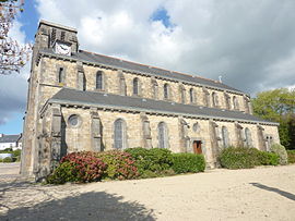 The parish church of Sainte-Brigitte | |
 Coat of arms | |
show Location of Loperhet | |
 Loperhet | |
| Coordinates: 48°22′32″N 4°18′14″W / 48.3756°N 4.3039°WCoordinates: 48°22′32″N 4°18′14″W / 48.3756°N 4.3039°W | |
| Country | France |
| Region | Brittany |
| Department | Finistère |
| Arrondissement | Brest |
| Canton | Pont-de-Buis-lès-Quimerch |
| Intercommunality | Pays de Landerneau-Daoulas |
| Government | |
| • Mayor (2014–2020) | Jean-Paul Morvan |
| Area 1 | 20.31 km2 (7.84 sq mi) |
| Population (Jan. 2018)[1] | 3,835 |
| • Density | 190/km2 (490/sq mi) |
| Time zone | UTC+01:00 (CET) |
| • Summer (DST) | UTC+02:00 (CEST) |
| INSEE/Postal code | 29140 /29470 |
| Elevation | 0–162 m (0–531 ft) |
| 1 French Land Register data, which excludes lakes, ponds, glaciers > 1 km2 (0.386 sq mi or 247 acres) and river estuaries. | |


Loperhet (Breton: Loperc'hed) is a commune in the Finistère department of Brittany in north-western France.
Population[]
Inhabitants of Loperhet are called in French Loperhétois.
| Year | Pop. | ±% |
|---|---|---|
| 1962 | 1,280 | — |
| 1968 | 1,315 | +2.7% |
| 1975 | 1,411 | +7.3% |
| 1982 | 2,030 | +43.9% |
| 1990 | 2,941 | +44.9% |
| 1999 | 3,466 | +17.9% |
| 2008 | 3,558 | +2.7% |
Breton language[]
The municipality launched a linguistic plan concerning the Breton language through Ya d'ar brezhoneg on 22 October 2008.
In 2008, 14.56% of primary-school children attended bilingual schools.[2]
See also[]
References[]
- ^ "Populations légales 2018". INSEE. 28 December 2020.
- ^ (in French) Ofis ar Brezhoneg: Enseignement bilingue
External links[]
| Wikimedia Commons has media related to Loperhet. |
- Official website (in French)
- Base Mérimée: Search for heritage in the commune, Ministère français de la Culture. (in French)
- Mayors of Finistère Association (in French)
This Finistère geographical article is a stub. You can help Wikipedia by . |
Categories:
- Communes of Finistère
- Finistère geography stubs