Quéménéven
Quéménéven
Kemeneven | |
|---|---|
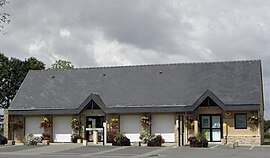 The town hall in Quéménéven | |
show Location of Quéménéven | |
 Quéménéven | |
| Coordinates: 48°06′53″N 4°07′14″W / 48.1147°N 4.1206°WCoordinates: 48°06′53″N 4°07′14″W / 48.1147°N 4.1206°W | |
| Country | France |
| Region | Brittany |
| Department | Finistère |
| Arrondissement | Quimper |
| Canton | Crozon |
| Intercommunality | Quimper Bretagne Occidentale |
| Government | |
| • Mayor (2020–2026) | Erwan Crouan |
| Area 1 | 28.21 km2 (10.89 sq mi) |
| Population (Jan. 2018)[1] | 1,116 |
| • Density | 40/km2 (100/sq mi) |
| Time zone | UTC+01:00 (CET) |
| • Summer (DST) | UTC+02:00 (CEST) |
| INSEE/Postal code | 29229 /29180 |
| Elevation | 52–280 m (171–919 ft) |
| 1 French Land Register data, which excludes lakes, ponds, glaciers > 1 km2 (0.386 sq mi or 247 acres) and river estuaries. | |


Quéménéven (French pronunciation: [kemenevɛ̃]; Breton: Kemeneven) is a commune in the Finistère department of Brittany in northwestern France. Notable monuments include the Quéménéven Parish close in the village centre, and the Kergoat chapel in the hamlet Kergoat.
Population[]
Inhabitants of Quéménéven are called in French Quéménévenois.
See also[]
References[]
- ^ "Populations légales 2018". INSEE. 28 December 2020.
External links[]
| Wikimedia Commons has media related to Quéménéven. |
- Official website (in French)
- Base Mérimée: Search for heritage in the commune, Ministère français de la Culture. (in French)
- Mayors of Finistère Association (in French)
This Finistère geographical article is a stub. You can help Wikipedia by . |
Categories:
- Communes of Finistère
- Finistère geography stubs