Plouguin
Plouguin
Plougin | |
|---|---|
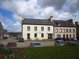 The town hall in Plouguin | |
 Coat of arms | |
show Location of Plouguin | |
 Plouguin | |
| Coordinates: 48°31′31″N 4°36′00″W / 48.5253°N 4.6000°WCoordinates: 48°31′31″N 4°36′00″W / 48.5253°N 4.6000°W | |
| Country | France |
| Region | Brittany |
| Department | Finistère |
| Arrondissement | Brest |
| Canton | Plabennec |
| Government | |
| • Mayor (2020–2026) | Roger Talarmain[1] |
| Area 1 | 31.02 km2 (11.98 sq mi) |
| Population (Jan. 2018)[2] | 2,160 |
| • Density | 70/km2 (180/sq mi) |
| Time zone | UTC+01:00 (CET) |
| • Summer (DST) | UTC+02:00 (CEST) |
| INSEE/Postal code | 29196 /29830 |
| Elevation | 0–82 m (0–269 ft) |
| 1 French Land Register data, which excludes lakes, ponds, glaciers > 1 km2 (0.386 sq mi or 247 acres) and river estuaries. | |


Plouguin (French pronunciation: [pluɡɛ̃]; Occitan: Plougin) is a commune in the Finistère department of Brittany in north-western France.
It lies 20 km (12 mi) northwest of Brest, about 7 km (4.3 mi) from the English Channel in the far west of the Leon peninsula.
Population[]
Inhabitants of Plouguin are called in French Plouguinois.
Saint Winwaloe[]
Plouguin is considered to have been (about 460) the birthplace of Saint Winwaloe, and his supposed place of birth, a feudal hillock, is still pointed out.
International relations[]
Plouguin is twinned with the town of Newport in Pembrokeshire, Wales.
See also[]
References[]
- ^ "Répertoire national des élus: les maires". data.gouv.fr, Plateforme ouverte des données publiques françaises (in French). 2 December 2020.
- ^ "Populations légales 2018". INSEE. 28 December 2020.
External links[]
| Wikimedia Commons has media related to Plouguin. |
- Official website
- Base Mérimée: Search for heritage in the commune, Ministère français de la Culture. (in French)
- Plouguin Website (in French)
- Mayors of Finistère Association (in French)
This Finistère geographical article is a stub. You can help Wikipedia by . |
Categories:
- Communes of Finistère
- Finistère geography stubs