Herbeys
Herbeys | |
|---|---|
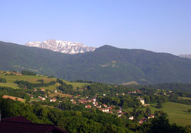 A general view of Herbeys | |
 Coat of arms | |
show Location of Herbeys | |
 Herbeys | |
| Coordinates: 45°08′20″N 5°47′36″E / 45.1390°N 5.7934°ECoordinates: 45°08′20″N 5°47′36″E / 45.1390°N 5.7934°E | |
| Country | France |
| Region | Auvergne-Rhône-Alpes |
| Department | Isère |
| Arrondissement | Grenoble |
| Canton | Le Pont-de-Claix |
| Intercommunality | Grenoble-Alpes Métropole |
| Government | |
| • Mayor (2020–2026) | Françoise Fontana[1] |
| Area 1 | 7.73 km2 (2.98 sq mi) |
| Population (Jan. 2018)[2] | 1,361 |
| • Density | 180/km2 (460/sq mi) |
| Time zone | UTC+01:00 (CET) |
| • Summer (DST) | UTC+02:00 (CEST) |
| INSEE/Postal code | 38188 /38320 |
| Elevation | 417–935 m (1,368–3,068 ft) |
| 1 French Land Register data, which excludes lakes, ponds, glaciers > 1 km2 (0.386 sq mi or 247 acres) and river estuaries. | |


show This article may be expanded with text translated from the corresponding article in French. (December 2009) Click [show] for important translation instructions. |
Herbeys is a commune in the Isère department in southeastern France.
Population[]
|
|
See also[]
References[]
- ^ "Répertoire national des élus: les maires". data.gouv.fr, Plateforme ouverte des données publiques françaises (in French). 2 December 2020.
- ^ "Populations légales 2018". INSEE. 28 December 2020.
External links[]
| Wikimedia Commons has media related to Herbeys. |
| show Authority control |
|---|
This Isère geographical article is a stub. You can help Wikipedia by . |
Categories:
- Communes of Isère
- Isère geography stubs