Meillonnas
show This article may be expanded with text translated from the corresponding article in French. (December 2008) Click [show] for important translation instructions. |
Meillonnas | |
|---|---|
Commune | |
 The town hall in Meillonnas | |
 Coat of arms | |
show Location of Meillonnas | |
 Meillonnas | |
| Coordinates: 46°14′45″N 5°21′09″E / 46.2458°N 5.3525°ECoordinates: 46°14′45″N 5°21′09″E / 46.2458°N 5.3525°E | |
| Country | France |
| Region | Auvergne-Rhône-Alpes |
| Department | Ain |
| Arrondissement | Bourg-en-Bresse |
| Canton | Saint-Étienne-du-Bois |
| Intercommunality | CA Bassin de Bourg-en-Bresse |
| Government | |
| • Mayor (2020–2026) | Jean-Pierre Arragon |
| Area 1 | 17.74 km2 (6.85 sq mi) |
| Population (Jan. 2018)[1] | 1,345 |
| • Density | 76/km2 (200/sq mi) |
| Time zone | UTC+01:00 (CET) |
| • Summer (DST) | UTC+02:00 (CEST) |
| INSEE/Postal code | 01241 /01370 |
| Elevation | 232–460 m (761–1,509 ft) (avg. 279 m or 915 ft) |
| 1 French Land Register data, which excludes lakes, ponds, glaciers > 1 km2 (0.386 sq mi or 247 acres) and river estuaries. | |


Meillonnas is a commune in the Ain department in eastern France.
Geography[]
The Sevron has its source in the commune; it crosses the village and forms part of the commune's northern border.
The bief du Bois Tharlet, a tributary of the Sevron, forms most of the commune's western border.
Population[]
| Year | Pop. | ±% |
|---|---|---|
| 1962 | 610 | — |
| 1968 | 630 | +3.3% |
| 1975 | 671 | +6.5% |
| 1982 | 891 | +32.8% |
| 1990 | 1,051 | +18.0% |
| 1999 | 1,204 | +14.6% |
| 2008 | 1,298 | +7.8% |
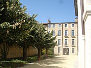
Hotel of Meillonnas
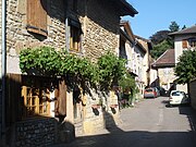
Ancient Street


See also[]
References[]
- ^ "Populations légales 2018". INSEE. 28 December 2020.
External links[]
 Media related to Meillonnas at Wikimedia Commons
| show Authority control |
|---|
This Ain geographical article is a stub. You can help Wikipedia by . |
Categories:
- Communes of Ain
- Ain geography stubs