Monestier-de-Clermont
Monestier-de-Clermont | |
|---|---|
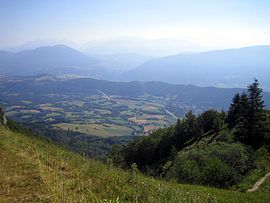 A general view of Monestier-de-Clermont | |
 Coat of arms | |
show Location of Monestier-de-Clermont | |
 Monestier-de-Clermont | |
| Coordinates: 44°55′04″N 5°38′10″E / 44.9178°N 5.6361°ECoordinates: 44°55′04″N 5°38′10″E / 44.9178°N 5.6361°E | |
| Country | France |
| Region | Auvergne-Rhône-Alpes |
| Department | Isère |
| Arrondissement | Grenoble |
| Canton | Matheysine-Trièves |
| Government | |
| • Mayor (2020–2026) | Éric Furmanczak |
| Area 1 | 5 km2 (2 sq mi) |
| Population (Jan. 2018)[1] | 1,428 |
| • Density | 290/km2 (740/sq mi) |
| Time zone | UTC+01:00 (CET) |
| • Summer (DST) | UTC+02:00 (CEST) |
| INSEE/Postal code | 38242 /38650 |
| Elevation | 679–1,070 m (2,228–3,510 ft) (avg. 832 m or 2,730 ft) |
| 1 French Land Register data, which excludes lakes, ponds, glaciers > 1 km2 (0.386 sq mi or 247 acres) and river estuaries. | |


show This article may be expanded with text translated from the corresponding article in French. (December 2009) Click [show] for important translation instructions. |
Monestier-de-Clermont (French pronunciation: [mɔnɛstje də klɛʁmɔ̃]) is a commune in the Isère department in southeastern France.
Population[]
| Year | Pop. | ±% |
|---|---|---|
| 1793 | 547 | — |
| 1806 | 548 | +0.2% |
| 1821 | 568 | +3.6% |
| 1831 | 752 | +32.4% |
| 1841 | 837 | +11.3% |
| 1851 | 902 | +7.8% |
| 1861 | 810 | −10.2% |
| 1872 | 370 | −54.3% |
| 1881 | 779 | +110.5% |
| 1891 | 631 | −19.0% |
| 1901 | 574 | −9.0% |
| 1911 | 527 | −8.2% |
| 1921 | 579 | +9.9% |
| 1931 | 623 | +7.6% |
| 1846 | 653 | +4.8% |
| 1954 | 805 | +23.3% |
| 1962 | 905 | +12.4% |
| 1968 | 787 | −13.0% |
| 1975 | 726 | −7.8% |
| 1982 | 736 | +1.4% |
| 1990 | 905 | +23.0% |
| 1999 | 921 | +1.8% |
| 2006 | 1,104 | +19.9% |
| 2011 | 1,313 | +18.9% |
See also[]
References[]
- ^ "Populations légales 2018". INSEE. 28 December 2020.
| Wikimedia Commons has media related to Monestier-de-Clermont. |
| show Authority control |
|---|
This Isère geographical article is a stub. You can help Wikipedia by . |
Categories:
- Communes of Isère
- Isère geography stubs