Oulles
Oulles | |
|---|---|
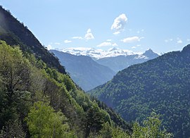 The landscape around Oulles | |
show Location of Oulles | |
 Oulles | |
| Coordinates: 45°04′30″N 5°59′00″E / 45.075°N 5.9833°ECoordinates: 45°04′30″N 5°59′00″E / 45.075°N 5.9833°E | |
| Country | France |
| Region | Auvergne-Rhône-Alpes |
| Department | Isère |
| Arrondissement | Grenoble |
| Canton | Oisans-Romanche |
| Intercommunality | |
| Government | |
| • Mayor (2020–2026) | Stéphane Girard |
| Area 1 | 11 km2 (4 sq mi) |
| Population (Jan. 2018)[1] | 6 |
| • Density | 0.55/km2 (1.4/sq mi) |
| Time zone | UTC+01:00 (CET) |
| • Summer (DST) | UTC+02:00 (CEST) |
| INSEE/Postal code | 38286 /38520 |
| Elevation | 728–2,559 m (2,388–8,396 ft) |
| 1 French Land Register data, which excludes lakes, ponds, glaciers > 1 km2 (0.386 sq mi or 247 acres) and river estuaries. | |


show This article may be expanded with text translated from the corresponding article in French. (December 2009) Click [show] for important translation instructions. |
Oulles (French pronunciation: [ul]) is a commune in the Isère department in southeastern France. It is at 1,400 metres (4,600 ft) on the Taillefer massif.
Population[]
| Year | Pop. | ±% |
|---|---|---|
| 2006 | 12 | — |
| 2007 | 12 | +0.0% |
| 2008 | 11 | −8.3% |
| 2009 | 12 | +9.1% |
| 2010 | 12 | +0.0% |
| 2011 | 12 | +0.0% |
| 2012 | 12 | +0.0% |
| 2013 | 12 | +0.0% |
| 2014 | 10 | −16.7% |
| 2015 | 9 | −10.0% |
| 2016 | 7 | −22.2% |
Politics[]
Presidential Elections Second Round:[2]
| Election | Winning Candidate | Party | % | |
|---|---|---|---|---|
| 2017 | Marine Le Pen | FN | 66.67 | |
| 2012 | Nicolas Sarkozy | UMP | 56.67 | |
| 2007 | Nicolas Sarkozy | UMP | 63.64 | |
| 2002 | Jacques Chirac | RPR | 57.58 | |
See also[]
References[]
- ^ "Populations légales 2018". INSEE. 28 December 2020.
- ^ "Résultats France - Présidentielle 2017 - 1er et 2nd tour".
| Wikimedia Commons has media related to Oulles. |
This Isère geographical article is a stub. You can help Wikipedia by . |
Categories:
- Communes of Isère
- Isère geography stubs