Rochetoirin
Rochetoirin | |
|---|---|
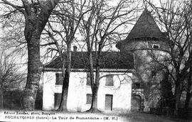 The château of Romanèche at the start of the 20th century | |
show Location of Rochetoirin | |
 Rochetoirin | |
| Coordinates: 45°34′57″N 5°25′08″E / 45.5825°N 5.4189°ECoordinates: 45°34′57″N 5°25′08″E / 45.5825°N 5.4189°E | |
| Country | France |
| Region | Auvergne-Rhône-Alpes |
| Department | Isère |
| Arrondissement | La Tour-du-Pin |
| Canton | La Tour-du-Pin |
| Government | |
| • Mayor (2020–2026) | Marie-Christine Frachon[1] |
| Area 1 | 10.62 km2 (4.10 sq mi) |
| Population (Jan. 2018)[2] | 1,104 |
| • Density | 100/km2 (270/sq mi) |
| Time zone | UTC+01:00 (CET) |
| • Summer (DST) | UTC+02:00 (CEST) |
| INSEE/Postal code | 38341 /38110 |
| Elevation | 302–487 m (991–1,598 ft) |
| 1 French Land Register data, which excludes lakes, ponds, glaciers > 1 km2 (0.386 sq mi or 247 acres) and river estuaries. | |


show This article may be expanded with text translated from the corresponding article in French. (December 2009) Click [show] for important translation instructions. |
Rochetoirin (French pronunciation: [ʁɔʃtwaʁɛ̃]) is a commune in the Isère department in southeastern France.
Population[]
|
|
Twin towns[]
Rochetoirin is twinned with:
 Aspach-le-Haut, France
See also[]
References[]
- ^ "Répertoire national des élus: les maires". data.gouv.fr, Plateforme ouverte des données publiques françaises (in French). 2 December 2020.
- ^ "Populations légales 2018". INSEE. 28 December 2020.
| Wikimedia Commons has media related to Rochetoirin. |
This Isère geographical article is a stub. You can help Wikipedia by . |
Categories:
- Communes of Isère
- Isère geography stubs