Roybon
Roybon | |
|---|---|
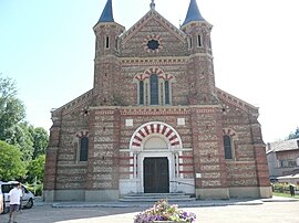 The church of Roybon | |
 Coat of arms | |
show Location of Roybon | |
 Roybon | |
| Coordinates: 45°15′34″N 5°14′42″E / 45.2594°N 5.245°ECoordinates: 45°15′34″N 5°14′42″E / 45.2594°N 5.245°E | |
| Country | France |
| Region | Auvergne-Rhône-Alpes |
| Department | Isère |
| Arrondissement | Vienne |
| Canton | Bièvre |
| Government | |
| • Mayor (2020–2026) | Serge Perraud[1] |
| Area 1 | 67.31 km2 (25.99 sq mi) |
| Population (Jan. 2018)[2] | 1,150 |
| • Density | 17/km2 (44/sq mi) |
| Time zone | UTC+01:00 (CET) |
| • Summer (DST) | UTC+02:00 (CEST) |
| INSEE/Postal code | 38347 /38940 |
| Elevation | 436–729 m (1,430–2,392 ft) (avg. 500 m or 1,600 ft) |
| 1 French Land Register data, which excludes lakes, ponds, glaciers > 1 km2 (0.386 sq mi or 247 acres) and river estuaries. | |


show This article may be expanded with text translated from the corresponding article in French. (December 2009) Click [show] for important translation instructions. |
Roybon (French pronunciation: [ʁwa.bɔ̃]) is a commune in the Isère department in southeastern France.
Geography[]
The Galaure has its source in the commune.
Population[]
|
|
See also[]
References[]
- ^ "Répertoire national des élus: les maires". data.gouv.fr, Plateforme ouverte des données publiques françaises (in French). 2 December 2020.
- ^ "Populations légales 2018". INSEE. 28 December 2020.
| Wikimedia Commons has media related to Roybon. |
This Isère geographical article is a stub. You can help Wikipedia by . |
Categories:
- Communes of Isère
- Isère geography stubs