Ruy-Montceau
Ruy-Montceau | |
|---|---|
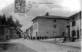 Ruy in 1907 | |
show Location of Ruy-Montceau | |
 Ruy-Montceau | |
| Coordinates: 45°35′21″N 5°19′07″E / 45.5892°N 5.3186°ECoordinates: 45°35′21″N 5°19′07″E / 45.5892°N 5.3186°E | |
| Country | France |
| Region | Auvergne-Rhône-Alpes |
| Department | Isère |
| Arrondissement | La Tour-du-Pin |
| Canton | Bourgoin-Jallieu |
| Intercommunality | CA Porte de l'Isère |
| Government | |
| • Mayor (2020–2026) | Denis Giraud |
| Area 1 | 20.81 km2 (8.03 sq mi) |
| Population (Jan. 2018)[1] | 4,606 |
| • Density | 220/km2 (570/sq mi) |
| Time zone | UTC+01:00 (CET) |
| • Summer (DST) | UTC+02:00 (CEST) |
| INSEE/Postal code | 38348 /38300 |
| Elevation | 244–505 m (801–1,657 ft) (avg. 260 m or 850 ft) |
| 1 French Land Register data, which excludes lakes, ponds, glaciers > 1 km2 (0.386 sq mi or 247 acres) and river estuaries. | |


show This article may be expanded with text translated from the corresponding article in French. (December 2009) Click [show] for important translation instructions. |
Ruy-Montceau (before August 2015: Ruy)[2] is a commune in the Isère department in southeastern France.
Geography[]
The Bourbre forms most of the commune's southwestern border.
Population[]
|
|
See also[]
References[]
| Wikimedia Commons has media related to Ruy-Montceau. |
- ^ "Populations légales 2018". INSEE. 28 December 2020.
- ^ Arrêté préfectoral, 4 August 2015.
This Isère geographical article is a stub. You can help Wikipedia by . |
Categories:
- Communes of Isère
- Isère geography stubs