Saint-Alban-de-Roche
show This article may be expanded with text translated from the corresponding article in French. (December 2009) Click [show] for important translation instructions. |
Saint-Alban-de-Roche | |
|---|---|
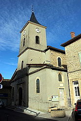 The church of Saint-Alban-de-Roche | |
 Coat of arms | |
show Location of Saint-Alban-de-Roche | |
 Saint-Alban-de-Roche | |
| Coordinates: 45°35′49″N 5°13′30″E / 45.5969°N 5.225°ECoordinates: 45°35′49″N 5°13′30″E / 45.5969°N 5.225°E | |
| Country | France |
| Region | Auvergne-Rhône-Alpes |
| Department | Isère |
| Arrondissement | La Tour-du-Pin |
| Canton | L'Isle-d'Abeau |
| Intercommunality | CA Porte de l'Isère |
| Government | |
| • Mayor (2014–2020) | Michel Guerin |
| Area 1 | 6.11 km2 (2.36 sq mi) |
| Population (Jan. 2018)[1] | 2,056 |
| • Density | 340/km2 (870/sq mi) |
| Time zone | UTC+01:00 (CET) |
| • Summer (DST) | UTC+02:00 (CEST) |
| INSEE/Postal code | 38352 /38080 |
| Elevation | 230–462 m (755–1,516 ft) |
| 1 French Land Register data, which excludes lakes, ponds, glaciers > 1 km2 (0.386 sq mi or 247 acres) and river estuaries. | |


Saint-Alban-de-Roche is a commune in the Isère department in southeastern France.
Population[]
| Year | Pop. | ±% |
|---|---|---|
| 1793 | 601 | — |
| 1806 | 668 | +11.1% |
| 1821 | 944 | +41.3% |
| 1831 | 908 | −3.8% |
| 1841 | 1,050 | +15.6% |
| 1851 | 1,080 | +2.9% |
| 1861 | 1,191 | +10.3% |
| 1872 | 1,100 | −7.6% |
| 1881 | 1,216 | +10.5% |
| 1891 | 1,157 | −4.9% |
| 1901 | 1,149 | −0.7% |
| 1911 | 997 | −13.2% |
| 1921 | 816 | −18.2% |
| 1931 | 1,004 | +23.0% |
| 1946 | 821 | −18.2% |
| 1954 | 907 | +10.5% |
| 1962 | 941 | +3.7% |
| 1968 | 944 | +0.3% |
| 1975 | 1,070 | +13.3% |
| 1982 | 1,289 | +20.5% |
| 1990 | 1,545 | +19.9% |
| 1999 | 1,760 | +13.9% |
| 2006 | 1,881 | +6.9% |
| 2011 | 1,806 | −4.0% |
See also[]
References[]
- ^ "Populations légales 2018". INSEE. 28 December 2020.
| Wikimedia Commons has media related to Saint-Alban-de-Roche. |
| show Authority control |
|---|
This Isère geographical article is a stub. You can help Wikipedia by . |
Categories:
- Communes of Isère
- Isère geography stubs