Saint-Chef
From Wikipedia, the free encyclopedia
show This article may be expanded with text translated from the corresponding article in French. (December 2009) Click [show] for important translation instructions.
|
Commune in Auvergne-Rhône-Alpes, France
Saint-Chef | |
|---|---|
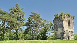 Tour du Poulet | |
 Coat of arms | |
 Saint-Chef  Saint-Chef | |
Coordinates:  45°38′05″N 5°21′59″E / 45.6347°N 5.3664°E / 45.6347; 5.3664Coordinates: 45°38′05″N 5°21′59″E / 45.6347°N 5.3664°E / 45.6347; 5.3664 45°38′05″N 5°21′59″E / 45.6347°N 5.3664°E / 45.6347; 5.3664Coordinates: 45°38′05″N 5°21′59″E / 45.6347°N 5.3664°E / 45.6347; 5.3664 | |
| Country | France |
| Region | Auvergne-Rhône-Alpes |
| Department | Isère |
| Arrondissement | La Tour-du-Pin |
| Canton | Bourgoin-Jallieu |
| Government | |
| • Mayor (2020–2026) | Alexandre Drogoz |
| Area 1 | 27.16 km2 (10.49 sq mi) |
| Population (Jan. 2018)[1] | 3,637 |
| • Density | 130/km2 (350/sq mi) |
| Time zone | UTC+01:00 (CET) |
| • Summer (DST) | UTC+02:00 (CEST) |
| INSEE/Postal code | 38374 /38890 |
| Elevation | 218–440 m (715–1,444 ft) |
| 1 French Land Register data, which excludes lakes, ponds, glaciers > 1 km2 (0.386 sq mi or 247 acres) and river estuaries. | |

Saint-Chef (French pronunciation: [sɛ̃ ʃɛf]) is a commune in the Isère department in southeastern France.
The commune is named after Saint Chef, who was born in the nearby hamlet of Arcisse.
See also[]
References[]
- ^ "Populations légales 2018". INSEE. 28 December 2020.
| Wikimedia Commons has media related to Saint-Chef. |
| show Authority control | |
|---|---|
| General |
|
| National libraries | |
| Other |
|
Retrieved from ""
Categories:
- Communes of Isère
- Isère geography stubs
Hidden categories:
- Articles to be expanded from December 2009
- All articles to be expanded
- Geography articles needing translation from French Wikipedia
- Articles with short description
- Short description is different from Wikidata
- Infobox mapframe without OSM relation ID on Wikidata
- Coordinates on Wikidata
- Pages using infobox settlement with image map1 but not image map
- Commons category link from Wikidata
- Articles with VIAF identifiers
- Articles with BNF identifiers
- Articles with LCCN identifiers
- Articles with MusicBrainz area identifiers
- Articles with WorldCat-VIAF identifiers
- Isère communes articles needing translation from French Wikipedia
- All stub articles
- Pages using the Kartographer extension