Saint-Marcel, Ain
Saint-Marcel | |
|---|---|
Commune | |
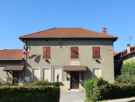 The town hall in Saint-Marcel | |
show Location of Saint-Marcel | |
 Saint-Marcel | |
| Coordinates: 45°56′58″N 4°59′17″E / 45.9494°N 4.9881°ECoordinates: 45°56′58″N 4°59′17″E / 45.9494°N 4.9881°E | |
| Country | France |
| Region | Auvergne-Rhône-Alpes |
| Department | Ain |
| Arrondissement | Bourg-en-Bresse |
| Canton | Villars-les-Dombes |
| Government | |
| • Mayor (2020–2026) | Dominique Petrone[1] |
| Area 1 | 11.64 km2 (4.49 sq mi) |
| Population (Jan. 2018)[2] | 1,258 |
| • Density | 110/km2 (280/sq mi) |
| Time zone | UTC+01:00 (CET) |
| • Summer (DST) | UTC+02:00 (CEST) |
| INSEE/Postal code | 01371 /01390 |
| Elevation | 278–292 m (912–958 ft) (avg. 286 m or 938 ft) |
| 1 French Land Register data, which excludes lakes, ponds, glaciers > 1 km2 (0.386 sq mi or 247 acres) and river estuaries. | |


Saint-Marcel (also known as Saint-Marcel-en-Dombes) is a commune in the Ain department in eastern France. As of 2016, the population is 1,328.[3]
Population[]
|
|
See also[]
References[]
- ^ "Répertoire national des élus: les maires". data.gouv.fr, Plateforme ouverte des données publiques françaises (in French). 2 December 2020.
- ^ "Populations légales 2018". INSEE. 28 December 2020.
- ^ "Populations légales 2016 Commune de Saint-Marcel (01371)". Institute national de la statistique et des études économiques.
| Wikimedia Commons has media related to Saint-Marcel, Ain. |
This Ain geographical article is a stub. You can help Wikipedia by . |
Categories:
- Communes of Ain
- Ain geography stubs