Tullins
show This article may be expanded with text translated from the corresponding article in French. (December 2009) Click [show] for important translation instructions. |
Tullins | |
|---|---|
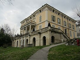 The town hall of Tullins | |
 Coat of arms | |
show Location of Tullins | |
 Tullins | |
| Coordinates: 45°17′54″N 5°29′01″E / 45.2983°N 5.4836°ECoordinates: 45°17′54″N 5°29′01″E / 45.2983°N 5.4836°E | |
| Country | France |
| Region | Auvergne-Rhône-Alpes |
| Department | Isère |
| Arrondissement | Grenoble |
| Canton | Tullins |
| Intercommunality | CA Pays Voironnais |
| Government | |
| • Mayor (2020–2026) | Gérald Cantournet |
| Area 1 | 28.79 km2 (11.12 sq mi) |
| Population (Jan. 2018)[1] | 7,719 |
| • Density | 270/km2 (690/sq mi) |
| Time zone | UTC+01:00 (CET) |
| • Summer (DST) | UTC+02:00 (CEST) |
| INSEE/Postal code | 38517 /38210 |
| Elevation | 179–784 m (587–2,572 ft) (avg. 210 m or 690 ft) |
| 1 French Land Register data, which excludes lakes, ponds, glaciers > 1 km2 (0.386 sq mi or 247 acres) and river estuaries. | |


Tullins (French pronunciation: [tylɛ̃]) is a commune in the Isère department in southeastern France.
Geography[]
The agglomeration of Tullins is situated in forested foothills that flank Chambaran Plateau. At its foot lies the alluvial plain of the Isère, which is the agricultural and rural part of the area. The town is traversed by the Fure and bordered by the Isère.
It is located 13 kilometres (8.1 mi) from Vinay and Voiron, 17 kilometres (11 mi) from Le Grand-Lemps, 19 kilometres (12 mi) from Grenoble-Isère International Airport, 23 kilometres (14 mi) from Saint-Marcellin, 26 kilometres (16 mi) from La Côte-Saint-André, and 29 kilometres (18 mi) from Grenoble. The city is served by the Tullins-Fures train station on Grenoble line and the A49 autoroute, which can be accessed 3 kilometres (1.9 mi) from the city center.
Population[]
|
|
See also[]
References[]
- ^ "Populations légales 2018". INSEE. 28 December 2020.
| Wikimedia Commons has media related to Tullins. |
| show Authority control |
|---|
This Isère geographical article is a stub. You can help Wikipedia by . |
- Communes of Isère
- Isère geography stubs