Étoile-Saint-Cyrice
Étoile-Saint-Cyrice | |
|---|---|
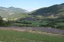 The valley of Étoile-Saint-Cyrice | |
show Location of Étoile-Saint-Cyrice | |
 Étoile-Saint-Cyrice | |
| Coordinates: 44°18′58″N 5°37′43″E / 44.3161°N 5.6286°ECoordinates: 44°18′58″N 5°37′43″E / 44.3161°N 5.6286°E | |
| Country | France |
| Region | Provence-Alpes-Côte d'Azur |
| Department | Hautes-Alpes |
| Arrondissement | Gap |
| Canton | Serres |
| Intercommunality | Sisteronais-Buëch |
| Government | |
| • Mayor (2020–2026) | Paul Jouve[1] |
| Area 1 | 14.41 km2 (5.56 sq mi) |
| Population (Jan. 2018)[2] | 30 |
| • Density | 2.1/km2 (5.4/sq mi) |
| Time zone | UTC+01:00 (CET) |
| • Summer (DST) | UTC+02:00 (CEST) |
| INSEE/Postal code | 05051 /05700 |
| Elevation | 698–1,296 m (2,290–4,252 ft) (avg. 880 m or 2,890 ft) |
| 1 French Land Register data, which excludes lakes, ponds, glaciers > 1 km2 (0.386 sq mi or 247 acres) and river estuaries. | |


Étoile-Saint-Cyrice (French pronunciation: [etwal sɛ̃ siʁis]; Occitan: Estela Sant Cirici) is a commune in the Hautes-Alpes department in southeastern France.
Geography[]

Population[]
| Year | Pop. | ±% |
|---|---|---|
| 1962 | 36 | — |
| 1968 | 39 | +8.3% |
| 1975 | 29 | −25.6% |
| 1982 | 20 | −31.0% |
| 1990 | 28 | +40.0% |
| 1999 | 31 | +10.7% |
| 2008 | 35 | +12.9% |
See also[]
- Communes of the Hautes-Alpes department
References[]
- ^ "Répertoire national des élus: les maires". data.gouv.fr, Plateforme ouverte des données publiques françaises (in French). 2 December 2020.
- ^ "Populations légales 2018". INSEE. 28 December 2020.
| Wikimedia Commons has media related to Étoile-Saint-Cyrice. |
This Hautes-Alpes geographical article is a stub. You can help Wikipedia by . |
Categories:
- Communes of Hautes-Alpes
- Hautes-Alpes geography stubs