Crots
Crots | |
|---|---|
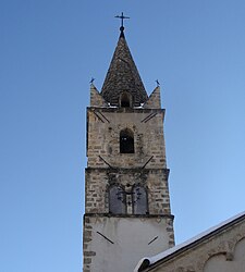 The bell tower of the church in Crots | |
 Coat of arms | |
show Location of Crots | |
 Crots | |
| Coordinates: 44°32′04″N 6°28′19″E / 44.5344°N 6.4719°ECoordinates: 44°32′04″N 6°28′19″E / 44.5344°N 6.4719°E | |
| Country | France |
| Region | Provence-Alpes-Côte d'Azur |
| Department | Hautes-Alpes |
| Arrondissement | Gap |
| Canton | Embrun |
| Government | |
| • Mayor (2020–2026) | Jean-Pierre Gandois[1] |
| Area 1 | 53.84 km2 (20.79 sq mi) |
| Population (Jan. 2018)[2] | 1,097 |
| • Density | 20/km2 (53/sq mi) |
| Time zone | UTC+01:00 (CET) |
| • Summer (DST) | UTC+02:00 (CEST) |
| INSEE/Postal code | 05045 /05200 |
| Elevation | 778–2,896 m (2,552–9,501 ft) (avg. 790 m or 2,590 ft) |
| 1 French Land Register data, which excludes lakes, ponds, glaciers > 1 km2 (0.386 sq mi or 247 acres) and river estuaries. | |


Crots is a commune in the Hautes-Alpes department in southeastern France. The territory of the commune belongs to the Écrins National Park.
Population[]
|
|
See also[]
- Communes of the Hautes-Alpes department
References[]
- ^ "Répertoire national des élus: les maires". data.gouv.fr, Plateforme ouverte des données publiques françaises (in French). 2 December 2020.
- ^ "Populations légales 2018". INSEE. 28 December 2020.
| Wikimedia Commons has media related to Crots. |
This Hautes-Alpes geographical article is a stub. You can help Wikipedia by . |
Categories:
- Communes of Hautes-Alpes
- Hautes-Alpes geography stubs