Aspremont, Hautes-Alpes
Aspremont | |
|---|---|
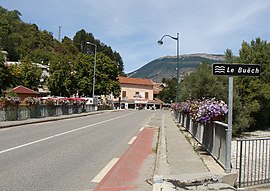 The bridge of the highway (formerly N75) over the River Buëch in Aspremont | |
show Location of Aspremont | |
 Aspremont | |
| Coordinates: 44°29′36″N 5°43′42″E / 44.4933°N 5.7283°ECoordinates: 44°29′36″N 5°43′42″E / 44.4933°N 5.7283°E | |
| Country | France |
| Region | Provence-Alpes-Côte d'Azur |
| Department | Hautes-Alpes |
| Arrondissement | Gap |
| Canton | Serres |
| Intercommunality | |
| Government | |
| • Mayor (2020–2026) | Jacques Francou[1] |
| Area 1 | 18.52 km2 (7.15 sq mi) |
| Population (Jan. 2018)[2] | 363 |
| • Density | 20/km2 (51/sq mi) |
| Time zone | UTC+01:00 (CET) |
| • Summer (DST) | UTC+02:00 (CEST) |
| INSEE/Postal code | 05008 /05140 |
| Elevation | 696–1,378 m (2,283–4,521 ft) (avg. 715 m or 2,346 ft) |
| 1 French Land Register data, which excludes lakes, ponds, glaciers > 1 km2 (0.386 sq mi or 247 acres) and river estuaries. | |


Aspremont is a commune in the Hautes-Alpes department in southeastern France.
Population[]
| Year | Pop. | ±% |
|---|---|---|
| 2006 | 294 | — |
| 2007 | 303 | +3.1% |
| 2008 | 306 | +1.0% |
| 2009 | 315 | +2.9% |
| 2010 | 320 | +1.6% |
| 2011 | 324 | +1.2% |
| 2012 | 327 | +0.9% |
| 2013 | 326 | −0.3% |
| 2014 | 332 | +1.8% |
| 2015 | 341 | +2.7% |
| 2016 | 350 | +2.6% |
Politics[]
Presidential Elections 2nd Round[]
| Election | Winning Candidate | Party | % | |
|---|---|---|---|---|
| 2017 | Marine Le Pen | FN | 57.84 | |
| 2012 | François Hollande | PS | 52.38 | |
| 2007 | Nicolas Sarkozy | UMP | 53.11 | |
| 2002 | Jacques Chirac | RPR | 77.09 | |
See also[]
- Communes of the Hautes-Alpes department
References[]
- ^ "Répertoire national des élus: les maires". data.gouv.fr, Plateforme ouverte des données publiques françaises (in French). 2 December 2020.
- ^ "Populations légales 2018". INSEE. 28 December 2020.
- ^ "Résultats France - Présidentielle 2017 - 1er et 2nd tour".
| Wikimedia Commons has media related to Aspremont (Hautes-Alpes). |
This Hautes-Alpes geographical article is a stub. You can help Wikipedia by . |
Categories:
- Communes of Hautes-Alpes
- Hautes-Alpes geography stubs