Les Vigneaux
Les Vigneaux | |
|---|---|
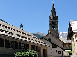 The church of Saint-Laurent, in Les Vigneaux | |
 Coat of arms | |
Location of Les Vigneaux  | |
 Les Vigneaux | |
| Coordinates: 44°49′29″N 6°32′29″E / 44.8247°N 6.5414°ECoordinates: 44°49′29″N 6°32′29″E / 44.8247°N 6.5414°E | |
| Country | France |
| Region | Provence-Alpes-Côte d'Azur |
| Department | Hautes-Alpes |
| Arrondissement | Briançon |
| Canton | L'Argentière-la-Bessée |
| Intercommunality | Pays des Écrins |
| Government | |
| • Mayor (2020–2026) | Gilles Pierre |
| Area 1 | 15.99 km2 (6.17 sq mi) |
| Population (Jan. 2018)[1] | 539 |
| • Density | 34/km2 (87/sq mi) |
| Time zone | UTC+01:00 (CET) |
| • Summer (DST) | UTC+02:00 (CEST) |
| INSEE/Postal code | 05180 /05120 |
| Elevation | 978–2,800 m (3,209–9,186 ft) (avg. 1,120 m or 3,670 ft) |
| 1 French Land Register data, which excludes lakes, ponds, glaciers > 1 km2 (0.386 sq mi or 247 acres) and river estuaries. | |


Les Vigneaux (French pronunciation: [le viɲo]; Occitan: Los Vinhaus) is a commune in the Hautes-Alpes department in southeastern France.
Population[]
| Year | Pop. | ±% |
|---|---|---|
| 1962 | 195 | — |
| 1968 | 208 | +6.7% |
| 1975 | 190 | −8.7% |
| 1982 | 244 | +28.4% |
| 1990 | 346 | +41.8% |
| 1999 | 390 | +12.7% |
| 2008 | 464 | +19.0% |
See also[]
- Communes of the Hautes-Alpes department
References[]
- ^ "Populations légales 2018". The National Institute of Statistics and Economic Studies. 28 December 2020.
| Wikimedia Commons has media related to Les Vigneaux. |
This Hautes-Alpes geographical article is a stub. You can help Wikipedia by . |
Categories:
- Communes of Hautes-Alpes
- Hautes-Alpes geography stubs