Rambaud, Hautes-Alpes
Rambaud | |
|---|---|
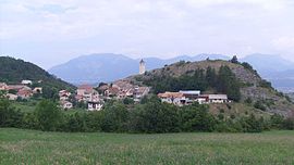 A general view of the village of Rambaud | |
 Coat of arms | |
show Location of Rambaud | |
 Rambaud | |
| Coordinates: 44°32′45″N 6°07′59″E / 44.5458°N 6.1331°ECoordinates: 44°32′45″N 6°07′59″E / 44.5458°N 6.1331°E | |
| Country | France |
| Region | Provence-Alpes-Côte d'Azur |
| Department | Hautes-Alpes |
| Arrondissement | Gap |
| Canton | Tallard |
| Government | |
| • Mayor (2020–2026) | Lionel Roux[1] |
| Area 1 | 10.71 km2 (4.14 sq mi) |
| Population (Jan. 2018)[2] | 376 |
| • Density | 35/km2 (91/sq mi) |
| Time zone | UTC+01:00 (CET) |
| • Summer (DST) | UTC+02:00 (CEST) |
| INSEE/Postal code | 05113 /05000 |
| Elevation | 793–1,260 m (2,602–4,134 ft) (avg. 950 m or 3,120 ft) |
| 1 French Land Register data, which excludes lakes, ponds, glaciers > 1 km2 (0.386 sq mi or 247 acres) and river estuaries. | |


Rambaud is a commune in the Hautes-Alpes department in southeastern France.
Population[]
| Year | Pop. | ±% |
|---|---|---|
| 1962 | 162 | — |
| 1968 | 182 | +12.3% |
| 1975 | 218 | +19.8% |
| 1982 | 271 | +24.3% |
| 1990 | 294 | +8.5% |
| 1999 | 279 | −5.1% |
| 2008 | 361 | +29.4% |
See also[]
- Communes of the Hautes-Alpes department
References[]
- ^ "Répertoire national des élus: les maires". data.gouv.fr, Plateforme ouverte des données publiques françaises (in French). 2 December 2020.
- ^ "Populations légales 2018". INSEE. 28 December 2020.
| Wikimedia Commons has media related to Rambaud. |
This Hautes-Alpes geographical article is a stub. You can help Wikipedia by . |
Categories:
- Communes of Hautes-Alpes
- Hautes-Alpes geography stubs