Villar-Saint-Pancrace
Villar-Saint-Pancrace | |
|---|---|
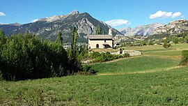 The chapel of Saint-Pancrace, in Villar-Saint-Pancrace | |
show Location of Villar-Saint-Pancrace | |
 Villar-Saint-Pancrace | |
| Coordinates: 44°52′25″N 6°37′40″E / 44.8736°N 6.6278°ECoordinates: 44°52′25″N 6°37′40″E / 44.8736°N 6.6278°E | |
| Country | France |
| Region | Provence-Alpes-Côte d'Azur |
| Department | Hautes-Alpes |
| Arrondissement | Briançon |
| Canton | Briançon-1 |
| Intercommunality | Briançonnais |
| Government | |
| • Mayor (2020–2026) | Sébastien Fine[1] |
| Area 1 | 42.53 km2 (16.42 sq mi) |
| Population (Jan. 2018)[2] | 1,476 |
| • Density | 35/km2 (90/sq mi) |
| Time zone | UTC+01:00 (CET) |
| • Summer (DST) | UTC+02:00 (CEST) |
| INSEE/Postal code | 05183 /05100 |
| Elevation | 1,160–2,903 m (3,806–9,524 ft) (avg. 1,260 m or 4,130 ft) |
| 1 French Land Register data, which excludes lakes, ponds, glaciers > 1 km2 (0.386 sq mi or 247 acres) and river estuaries. | |


Villar-Saint-Pancrace (French pronunciation: [vilaʁ sɛ̃ pɑ̃kʁas], also known as Grand Villar or le Villar; Occitan: Lo Vialar e Sant Prancaci) is a commune in the Hautes-Alpes department in southeastern France.
Population[]
| Year | Pop. | ±% |
|---|---|---|
| 1962 | 899 | — |
| 1968 | 960 | +6.8% |
| 1975 | 1,023 | +6.6% |
| 1982 | 1,117 | +9.2% |
| 1990 | 1,287 | +15.2% |
| 1999 | 1,410 | +9.6% |
| 2008 | 1,452 | +3.0% |
See also[]
- Communes of the Hautes-Alpes department
References[]
- ^ "Répertoire national des élus: les maires". data.gouv.fr, Plateforme ouverte des données publiques françaises (in French). 2 December 2020.
- ^ "Populations légales 2018". INSEE. 28 December 2020.
| Wikimedia Commons has media related to Villar-Saint-Pancrace. |
| show Authority control |
|---|
This Hautes-Alpes geographical article is a stub. You can help Wikipedia by . |
Categories:
- Communes of Hautes-Alpes
- Hautes-Alpes geography stubs