Saint-Crépin, Hautes-Alpes
Saint-Crépin | |
|---|---|
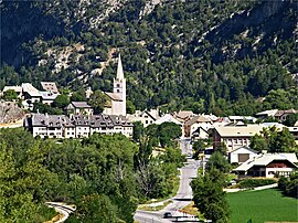 The village of Saint-Crépin, with the church and surrounding buildings | |
 Coat of arms | |
show Location of Saint-Crépin | |
 Saint-Crépin | |
| Coordinates: 44°42′27″N 6°36′29″E / 44.7075°N 6.6081°ECoordinates: 44°42′27″N 6°36′29″E / 44.7075°N 6.6081°E | |
| Country | France |
| Region | Provence-Alpes-Côte d'Azur |
| Department | Hautes-Alpes |
| Arrondissement | Briançon |
| Canton | Guillestre |
| Government | |
| • Mayor (2020–2026) | Jean-Louis Queyras[1] |
| Area 1 | 46.3 km2 (17.9 sq mi) |
| Population (Jan. 2018)[2] | 735 |
| • Density | 16/km2 (41/sq mi) |
| Time zone | UTC+01:00 (CET) |
| • Summer (DST) | UTC+02:00 (CEST) |
| INSEE/Postal code | 05136 /05600 |
| Elevation | 894–2,905 m (2,933–9,531 ft) (avg. 920 m or 3,020 ft) |
| 1 French Land Register data, which excludes lakes, ponds, glaciers > 1 km2 (0.386 sq mi or 247 acres) and river estuaries. | |


Saint-Crépin (French pronunciation: [sɛ̃ kʁepɛ̃]; Occitan: Sant Crespin) is a commune in the Hautes-Alpes department in southeastern France.
Population[]
| Year | Pop. | ±% |
|---|---|---|
| 1962 | 391 | — |
| 1968 | 400 | +2.3% |
| 1975 | 402 | +0.5% |
| 1982 | 507 | +26.1% |
| 1990 | 533 | +5.1% |
| 1999 | 541 | +1.5% |
| 2008 | 592 | +9.4% |
See also[]
- Communes of the Hautes-Alpes department
References[]
- ^ "Répertoire national des élus: les maires". data.gouv.fr, Plateforme ouverte des données publiques françaises (in French). 2 December 2020.
- ^ "Populations légales 2018". INSEE. 28 December 2020.
| Wikimedia Commons has media related to Saint-Crépin, Hautes-Alpes. |
| Authority control |
|
|---|
This Hautes-Alpes geographical article is a stub. You can help Wikipedia by . |
Categories:
- Communes of Hautes-Alpes
- Hautes-Alpes geography stubs