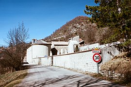
Montjay, Hautes-Alpes
Montjay | |
|---|---|
 | |
 Coat of arms | |
show Location of Montjay | |
 Montjay | |
| Coordinates: 44°21′39″N 5°36′16″E / 44.3608°N 5.6044°ECoordinates: 44°21′39″N 5°36′16″E / 44.3608°N 5.6044°E | |
| Country | France |
| Region | Provence-Alpes-Côte d'Azur |
| Department | Hautes-Alpes |
| Arrondissement | Gap |
| Canton | Serres |
| Government | |
| • Mayor (2020–2026) | Gilles Mostachetti[1] |
| Area 1 | 27 km2 (10 sq mi) |
| Population (Jan. 2018)[2] | 104 |
| • Density | 3.9/km2 (10.0/sq mi) |
| Time zone | UTC+01:00 (CET) |
| • Summer (DST) | UTC+02:00 (CEST) |
| INSEE/Postal code | 05086 /05150 |
| Elevation | 764–1,298 m (2,507–4,259 ft) (avg. 814 m or 2,671 ft) |
| 1 French Land Register data, which excludes lakes, ponds, glaciers > 1 km2 (0.386 sq mi or 247 acres) and river estuaries. | |


Montjay (French pronunciation: [mɔ̃ʒɛ]) is a commune in the Hautes-Alpes department in southeastern France.
Population[]
| Year | Pop. | ±% |
|---|---|---|
| 1962 | 75 | — |
| 1968 | 102 | +36.0% |
| 1975 | 76 | −25.5% |
| 1982 | 83 | +9.2% |
| 1990 | 86 | +3.6% |
| 1999 | 79 | −8.1% |
| 2008 | 100 | +26.6% |
See also[]
- Communes of the Hautes-Alpes department
References[]
- ^ "Répertoire national des élus: les maires". data.gouv.fr, Plateforme ouverte des données publiques françaises (in French). 2 December 2020.
- ^ "Populations légales 2018". INSEE. 28 December 2020.
| Wikimedia Commons has media related to Montjay, Hautes-Alpes. |
| Authority control |
|
|---|
This Hautes-Alpes geographical article is a stub. You can help Wikipedia by . |
Categories:
- Communes of Hautes-Alpes
- Hautes-Alpes geography stubs