Bovel
Bovel | |
|---|---|
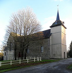 The church of Bovel | |
show Location of Bovel | |
 Bovel | |
| Coordinates: 47°57′03″N 1°58′33″W / 47.9508°N 1.9758°WCoordinates: 47°57′03″N 1°58′33″W / 47.9508°N 1.9758°W | |
| Country | France |
| Region | Brittany |
| Department | Ille-et-Vilaine |
| Arrondissement | Redon |
| Canton | Guichen |
| Government | |
| • Mayor (2020–2026) | José Mercier[1] |
| Area 1 | 14.60 km2 (5.64 sq mi) |
| Population (Jan. 2018)[2] | 602 |
| • Density | 41/km2 (110/sq mi) |
| Time zone | UTC+01:00 (CET) |
| • Summer (DST) | UTC+02:00 (CEST) |
| INSEE/Postal code | 35035 /35330 |
| Elevation | 45–128 m (148–420 ft) |
| 1 French Land Register data, which excludes lakes, ponds, glaciers > 1 km2 (0.386 sq mi or 247 acres) and river estuaries. | |


Bovel (Breton: Bovel, Gallo: Bovèu) is a commune in the Ille-et-Vilaine department in Brittany in north-France.
Population[]
| Year | Pop. | ±% |
|---|---|---|
| 1962 | 386 | — |
| 1968 | 388 | +0.5% |
| 1975 | 306 | −21.1% |
| 1982 | 303 | −1.0% |
| 1990 | 312 | +3.0% |
| 1999 | 331 | +6.1% |
| 2008 | 547 | +65.3% |
Inhabitants of Bovel are called Bovellois in French.
See also[]
- Communes of the Ille-et-Vilaine department
References[]
- ^ "Répertoire national des élus: les maires". data.gouv.fr, Plateforme ouverte des données publiques françaises (in French). 2 December 2020.
- ^ "Populations légales 2018". INSEE. 28 December 2020.
External links[]
| Wikimedia Commons has media related to Bovel. |
- Base Mérimée: Search for heritage in the commune, Ministère français de la Culture. (in French)
- Cultural Heritage at archive.today (archived 2013-02-17) (in French)
- Mayors of Ille-et-Vilaine Association (in French)
| show Communes of the Ille-et-Vilaine department |
|---|
This Ille-et-Vilaine geographical article is a stub. You can help Wikipedia by . |
Categories:
- Communes of Ille-et-Vilaine
- Ille-et-Vilaine geography stubs