Lalleu
Lalleu
An Alloz | |
|---|---|
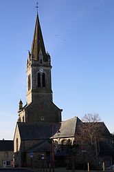 The church of Saint-Jean-Baptiste | |
show Location of Lalleu | |
 Lalleu | |
| Coordinates: 47°51′22″N 1°30′32″W / 47.8561°N 1.5089°WCoordinates: 47°51′22″N 1°30′32″W / 47.8561°N 1.5089°W | |
| Country | France |
| Region | Brittany |
| Department | Ille-et-Vilaine |
| Arrondissement | Redon |
| Canton | Bain-de-Bretagne |
| Intercommunality | Bretagne Porte de Loire |
| Government | |
| • Mayor (2020–2026) | Thierry Lassalle |
| Area 1 | 15.47 km2 (5.97 sq mi) |
| Population (Jan. 2018)[1] | 565 |
| • Density | 37/km2 (95/sq mi) |
| Time zone | UTC+01:00 (CET) |
| • Summer (DST) | UTC+02:00 (CEST) |
| INSEE/Postal code | 35140 /35320 |
| Elevation | 31–104 m (102–341 ft) |
| 1 French Land Register data, which excludes lakes, ponds, glaciers > 1 km2 (0.386 sq mi or 247 acres) and river estuaries. | |


Lalleu (French pronunciation: [lalø]; Breton: An Alloz) is a commune in the Ille-et-Vilaine department in Brittany in northwestern France.
Geography[]
The stream de la Couyère forms all of the commune's eastern border, then flows into the Semnon, which forms all of its southern border.
Population[]
Inhabitants of Lalleu are called Allodiens in French.
| Year | Pop. | ±% |
|---|---|---|
| 1962 | 497 | — |
| 1968 | 588 | +18.3% |
| 1975 | 506 | −13.9% |
| 1982 | 460 | −9.1% |
| 1990 | 445 | −3.3% |
| 1999 | 469 | +5.4% |
| 2008 | 565 | +20.5% |
See also[]
- Communes of the Ille-et-Vilaine department
References[]
- ^ "Populations légales 2018". INSEE. 28 December 2020.
External links[]
| Wikimedia Commons has media related to Lalleu. |
- Base Mérimée: Search for heritage in the commune, Ministère français de la Culture. (in French)
- Mayors of Ille-et-Vilaine Association (in French)
| show Communes of the Ille-et-Vilaine department |
|---|
This Ille-et-Vilaine geographical article is a stub. You can help Wikipedia by . |
Categories:
- Communes of Ille-et-Vilaine
- Ille-et-Vilaine geography stubs