Lourmais
Lourmais
An Oulmeg | |
|---|---|
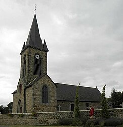 The church of Sainte-Anne, in Lourmais | |
show Location of Lourmais | |
 Lourmais | |
| Coordinates: 48°27′02″N 1°43′35″W / 48.4506°N 1.7264°WCoordinates: 48°27′02″N 1°43′35″W / 48.4506°N 1.7264°W | |
| Country | France |
| Region | Brittany |
| Department | Ille-et-Vilaine |
| Arrondissement | Saint-Malo |
| Canton | Combourg |
| Intercommunality | CC Bretagne Romantique |
| Government | |
| • Mayor (2014–2020) | Béatrice Duguépéroux |
| Area 1 | 7.22 km2 (2.79 sq mi) |
| Population (Jan. 2018)[1] | 328 |
| • Density | 45/km2 (120/sq mi) |
| Time zone | UTC+01:00 (CET) |
| • Summer (DST) | UTC+02:00 (CEST) |
| INSEE/Postal code | 35159 /35270 |
| Elevation | 60–111 m (197–364 ft) |
| 1 French Land Register data, which excludes lakes, ponds, glaciers > 1 km2 (0.386 sq mi or 247 acres) and river estuaries. | |


Lourmais (Breton: An Oulmeg) is a commune in the Ille-et-Vilaine department of Brittany in northwestern France.
Population[]
Inhabitants of Lourmais are called Lourmaisiens in French.
| Year | Pop. | ±% |
|---|---|---|
| 1962 | 255 | — |
| 1968 | 262 | +2.7% |
| 1975 | 261 | −0.4% |
| 1982 | 263 | +0.8% |
| 1990 | 274 | +4.2% |
| 1999 | 251 | −8.4% |
| 2008 | 317 | +26.3% |
See also[]
- Communes of the Ille-et-Vilaine department
References[]
- ^ "Populations légales 2018". INSEE. 28 December 2020.
External links[]
| Wikimedia Commons has media related to Lourmais. |
- Base Mérimée: Search for heritage in the commune, Ministère français de la Culture. (in French)
- Mayors of Ille-et-Vilaine Association (in French)
| show Communes of the Ille-et-Vilaine department |
|---|
This Ille-et-Vilaine geographical article is a stub. You can help Wikipedia by . |
Categories:
- Communes of Ille-et-Vilaine
- Ille-et-Vilaine geography stubs