Saint-Domineuc
Saint-Domineuc
Landoveneg | |
|---|---|
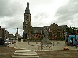 The church of Saint-Domineuc | |
show Location of Saint-Domineuc | |
 Saint-Domineuc | |
| Coordinates: 48°22′30″N 1°52′30″W / 48.3750°N 1.8750°WCoordinates: 48°22′30″N 1°52′30″W / 48.3750°N 1.8750°W | |
| Country | France |
| Region | Brittany |
| Department | Ille-et-Vilaine |
| Arrondissement | Saint-Malo |
| Canton | Combourg |
| Intercommunality | Bretagne Romantique |
| Government | |
| • Mayor (2020–2026) | Benoît Sohier[1] |
| Area 1 | 15.70 km2 (6.06 sq mi) |
| Population (Jan. 2018)[2] | 2,548 |
| • Density | 160/km2 (420/sq mi) |
| Time zone | UTC+01:00 (CET) |
| • Summer (DST) | UTC+02:00 (CEST) |
| INSEE/Postal code | 35265 /35190 |
| Elevation | 17–90 m (56–295 ft) |
| 1 French Land Register data, which excludes lakes, ponds, glaciers > 1 km2 (0.386 sq mi or 247 acres) and river estuaries. | |


Saint-Domineuc (Breton: Landoveneg) is a commune in the Ille-et-Vilaine département in Brittany in northwestern France.
Population[]
Inhabitants of Saint-Domineuc are called docmaëliens in French.
| Year | Pop. | ±% |
|---|---|---|
| 1962 | 979 | — |
| 1968 | 1,013 | +3.5% |
| 1975 | 1,127 | +11.3% |
| 1982 | 1,333 | +18.3% |
| 1990 | 1,339 | +0.5% |
| 1999 | 1,437 | +7.3% |
| 2009 | 2,208 | +53.7% |
| 2011 | 2,319 | +5.0% |
See also[]
- Communes of the Ille-et-Vilaine department
References[]
- ^ "Répertoire national des élus: les maires". data.gouv.fr, Plateforme ouverte des données publiques françaises (in French). 2 December 2020.
- ^ "Populations légales 2018". INSEE. 28 December 2020.
External links[]
| Wikimedia Commons has media related to Saint-Domineuc. |
- Mayors of Ille-et-Vilaine Association (in French)
| show Communes of the Ille-et-Vilaine department |
|---|
This Ille-et-Vilaine geographical article is a stub. You can help Wikipedia by . |
Categories:
- Communes of Ille-et-Vilaine
- Ille-et-Vilaine geography stubs