Ercé-en-Lamée
Ercé-en-Lamée
Herzieg-Mez | |
|---|---|
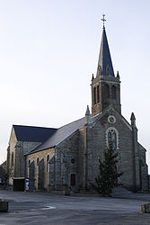 The church of Saint-Jean-Baptiste | |
show Location of Ercé-en-Lamée | |
 Ercé-en-Lamée | |
| Coordinates: 47°49′51″N 1°33′28″W / 47.8308°N 1.5578°WCoordinates: 47°49′51″N 1°33′28″W / 47.8308°N 1.5578°W | |
| Country | France |
| Region | Brittany |
| Department | Ille-et-Vilaine |
| Arrondissement | Redon |
| Canton | Bain-de-Bretagne |
| Intercommunality | Bretagne Porte de Loire |
| Government | |
| • Mayor (2020–2026) | Isabelle Bertin |
| Area 1 | 39.21 km2 (15.14 sq mi) |
| Population (Jan. 2018)[1] | 1,501 |
| • Density | 38/km2 (99/sq mi) |
| Time zone | UTC+01:00 (CET) |
| • Summer (DST) | UTC+02:00 (CEST) |
| INSEE/Postal code | 35106 /35620 |
| Elevation | 23–107 m (75–351 ft) |
| 1 French Land Register data, which excludes lakes, ponds, glaciers > 1 km2 (0.386 sq mi or 247 acres) and river estuaries. | |


Ercé-en-Lamée (French pronunciation: [ɛʁse ɑ̃ lame], literally Ercé in Lamée; Breton: Herzieg-Mez) is a commune in the Ille-et-Vilaine department in Brittany in northwestern France.
Geography[]
The river Semnon forms all of the commune's northern border.
Population[]
Inhabitants of Ercé-en-Lamée are called Ercéens in French.
| Year | Pop. | ±% |
|---|---|---|
| 1962 | 1,416 | — |
| 1968 | 1,542 | +8.9% |
| 1975 | 1,356 | −12.1% |
| 1982 | 1,253 | −7.6% |
| 1990 | 1,145 | −8.6% |
| 1999 | 1,156 | +1.0% |
| 2008 | 1,395 | +20.7% |
See also[]
- Communes of the Ille-et-Vilaine department
References[]
- ^ "Populations légales 2018". INSEE. 28 December 2020.
External links[]
| Wikimedia Commons has media related to Ercé-en-Lamée. |
- Base Mérimée: Search for heritage in the commune, Ministère français de la Culture. (in French)
- Mayors of Ille-et-Vilaine Association (in French)
| show Communes of the Ille-et-Vilaine department |
|---|
| show Authority control |
|---|
This Ille-et-Vilaine geographical article is a stub. You can help Wikipedia by . |
Categories:
- Communes of Ille-et-Vilaine
- Ille-et-Vilaine geography stubs