Laignelet
Laignelet
Kernoanig | |
|---|---|
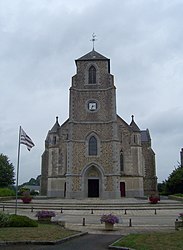 The church of Saint-Martin | |
 Coat of arms | |
show Location of Laignelet | |
 Laignelet | |
| Coordinates: 48°22′18″N 1°08′55″W / 48.3717°N 1.1486°WCoordinates: 48°22′18″N 1°08′55″W / 48.3717°N 1.1486°W | |
| Country | France |
| Region | Brittany |
| Department | Ille-et-Vilaine |
| Arrondissement | Fougères-Vitré |
| Canton | Fougères-2 |
| Intercommunality | Fougères |
| Government | |
| • Mayor (2020–2026) | André Philipot[1] |
| Area 1 | 14.83 km2 (5.73 sq mi) |
| Population (Jan. 2018)[2] | 1,166 |
| • Density | 79/km2 (200/sq mi) |
| Time zone | UTC+01:00 (CET) |
| • Summer (DST) | UTC+02:00 (CEST) |
| INSEE/Postal code | 35138 /35133 |
| Elevation | 104–231 m (341–758 ft) |
| 1 French Land Register data, which excludes lakes, ponds, glaciers > 1 km2 (0.386 sq mi or 247 acres) and river estuaries. | |


Laignelet (Breton: Kernoanig) is a commune in the Ille-et-Vilaine department of Brittany in north-western France.
Population[]
Inhabitants of Laignelet are called Agnelais in French.
| Year | Pop. | ±% |
|---|---|---|
| 1962 | 440 | — |
| 1968 | 479 | +8.9% |
| 1975 | 601 | +25.5% |
| 1982 | 641 | +6.7% |
| 1990 | 727 | +13.4% |
| 1999 | 789 | +8.5% |
See also[]
- Communes of the Ille-et-Vilaine department
References[]
- ^ "Répertoire national des élus: les maires". data.gouv.fr, Plateforme ouverte des données publiques françaises (in French). 2 December 2020.
- ^ "Populations légales 2018". INSEE. 28 December 2020.
External links[]
| Wikimedia Commons has media related to Laignelet. |
- Base Mérimée: Search for heritage in the commune, Ministère français de la Culture. (in French)
- Mayors of Ille-et-Vilaine Association (in French)
| show Communes of the Ille-et-Vilaine department |
|---|
This Ille-et-Vilaine geographical article is a stub. You can help Wikipedia by . |
Categories:
- Communes of Ille-et-Vilaine
- Ille-et-Vilaine geography stubs